Area Overview for DE55 7PR
Photos of DE55 7PR

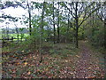
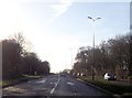
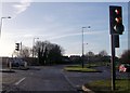
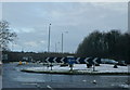

30 photos from this area
Area Information
Key information about the DE55 7PR including its size, population, and administrative classification.
- Area Type
- Postcode
- Area Size
- 21.7 hectares
- Population
- 1238
- Population Density
- 916 people/km²
House Prices in DE55 7PR
77
Properties
£331,499
Average Sold Price
£80,000
Lowest Price
£480,000
Highest Price
Showing 77 properties
| Address | Type | Beds | Baths | Last Sale Price | Last Sale Date | |
|---|---|---|---|---|---|---|
| 26 Damstead Park Avenue, Alfreton, DE55 7PR | house | - | - | £425,000 | Aug 2025 | |
| 56 Damstead Park Avenue, Alfreton, DE55 7PR | Detached | 5 | 3 | £437,500 | Jun 2025 | |
| 16 Damstead Park Avenue, Alfreton, DE55 7PR | Detached | 4 | 2 | £360,000 | May 2025 | |
| 46 Damstead Park Avenue, Alfreton, DE55 7PR | Detached | 3 | 3 | £315,000 | Mar 2025 | |
| 24 Damstead Park Avenue, Alfreton, DE55 7PR | Detached | 4 | 2 | £350,000 | Mar 2025 | |
| 62 Damstead Park Avenue, Alfreton, DE55 7PR | Detached | 3 | 2 | £322,000 | Jul 2024 | |
| 58 Damstead Park Avenue, Alfreton, DE55 7PR | Detached | 4 | 3 | £390,000 | Jul 2024 | |
| 35 Damstead Park Avenue, Alfreton, DE55 7PR | Semi-detached | 3 | 1 | £115,000 | Mar 2023 | |
| 15 Damstead Park Avenue, Alfreton, DE55 7PR | Retail | 4 | 2 | £415,000 | Jun 2022 | |
| 60 Damstead Park Avenue, Alfreton, DE55 7PR | Retail | 3 | 2 | £300,000 | Jun 2022 |
Page 1 of 8
Energy Efficiency in DE55 7PR
Amenities
Schools
| Rank | School | Type | Entry gender | Ages |
|---|
Explore more schools in this area
Go to Schools tabDemographics
Household Size
Two person
most common
Accommodation Type
Houses
most common
Tenure
93
majority
Ethnic Group
White
most common
Religion
N/A
most common
Household Composition
N/A
most common
Age
47
median
Adults (30-64 years)
most common
Household Deprivation
N/A
with no deprivation
NS-SEC
40
in Lower managerial occupations
Explore more demographic insights in this area
Go to Demographics tabPlanning
Planning Constraints
- Flood RiskPremium
- Ramsar Wetland SitesPremium
- Area of Outstanding Natural BeautyPremium
- Protected Nature ReservePremium
- Protected WoodlandPremium