Area Overview for DE55 7LH
Photos of DE55 7LH
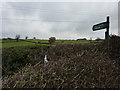
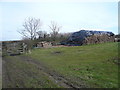
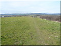
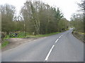

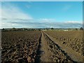
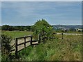
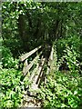
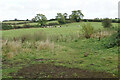


28 photos from this area
Area Information
Key information about the DE55 7LH including its size, population, and administrative classification.
- Area Type
- Postcode
- Area Size
- 43.5 hectares
- Population
- 2314
- Population Density
- 115 people/km²
House Prices in DE55 7LH
13
Properties
£312,667
Average Sold Price
£98,000
Lowest Price
£460,000
Highest Price
Showing 13 properties
| Address | Type | Beds | Baths | Last Sale Price | Last Sale Date | |
|---|---|---|---|---|---|---|
| The Briars, Wingfield Road, Oakerthorpe, Alfreton, DE55 7LH | house | - | - | £395,000 | May 2024 | |
| Oakswood, Wingfield Road, Oakerthorpe, Alfreton, DE55 7LH | Detached | 4 | 3 | £460,000 | Oct 2018 | |
| Inglenook, Wingfield Road, Oakerthorpe, Alfreton, DE55 7LH | Detached | 4 | 2 | £315,000 | Oct 2016 | |
| Ashley Rise, Wingfield Road, Oakerthorpe, Alfreton, DE55 7LH | Bungalow | - | - | £338,000 | Apr 2015 | |
| Hillside, Wingfield Road, Oakerthorpe, Alfreton, DE55 7LH | Detached | - | - | £270,000 | Jul 2009 | |
| Buxus, Wingfield Road, Oakerthorpe, Alfreton, DE55 7LH | Detached | - | - | £98,000 | Apr 1998 | |
| Wingfield Road Farm, Wingfield Road, Alfreton, DE55 7LH | Detached | 3 | 1 | - | - | |
| Westlands, Wingfield Road, Oakerthorpe, Alfreton, DE55 7LH | Detached | 4 | 2 | - | - | |
| Thurcroft House, Wingfield Road, Oakerthorpe, Alfreton, DE55 7LH | Detached | 4 | 2 | - | - | |
| The Old Post Office Cottage, Wingfield Road, Oakerthorpe, Alfreton, DE55 7LH | house | 3 | 2 | - | - |
Page 1 of 2
Energy Efficiency in DE55 7LH
Amenities
Schools
| Rank | School | Type | Entry gender | Ages |
|---|
Explore more schools in this area
Go to Schools tabDemographics
Household Size
Two person
most common
Accommodation Type
Houses
most common
Tenure
81
majority
Ethnic Group
White
most common
Religion
N/A
most common
Household Composition
N/A
most common
Age
47
median
Adults (30-64 years)
most common
Household Deprivation
N/A
with no deprivation
NS-SEC
38
in Lower managerial occupations
Explore more demographic insights in this area
Go to Demographics tabPlanning
Planning Constraints
- Flood RiskPremium
- Ramsar Wetland SitesPremium
- Area of Outstanding Natural BeautyPremium
- Protected Nature ReservePremium
- Protected WoodlandPremium