Area Overview for DE55 7JY
Photos of DE55 7JY
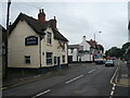
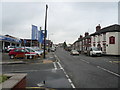
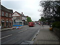
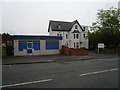
67 photos from this area
Area Information
Key information about the DE55 7JY including its size, population, and administrative classification.
- Area Type
- Postcode
- Area Size
- 1.7 hectares
- Population
- 1887
- Population Density
- 3342 people/km²
House Prices in DE55 7JY
42
Properties
£103,570
Average Sold Price
£19,657
Lowest Price
£151,000
Highest Price
Showing 42 properties
| Address | Type | Beds | Baths | Last Sale Price | Last Sale Date | |
|---|---|---|---|---|---|---|
| 59 Preston Avenue, Alfreton, DE55 7JY | house | - | - | £151,000 | Jan 2022 | |
| 41 Preston Avenue, Alfreton, DE55 7JY | Semi-detached | 3 | 1 | £129,950 | Mar 2021 | |
| 58 Preston Avenue, Alfreton, DE55 7JY | house | - | - | £115,000 | Mar 2020 | |
| 48 Preston Avenue, Alfreton, DE55 7JY | house | - | - | £123,000 | Apr 2017 | |
| 31 Preston Avenue, Alfreton, DE55 7JY | house | 3 | - | £94,950 | Dec 2015 | |
| 37 Preston Avenue, Alfreton, DE55 7JY | Semi-detached | 3 | - | £107,000 | Sep 2015 | |
| 64 Preston Avenue, Alfreton, DE55 7JY | Semi-detached | - | - | £88,000 | Apr 2006 | |
| 28 Preston Avenue, Alfreton, DE55 7JY | Semi-detached | - | - | £19,657 | Apr 2002 | |
| 29 Preston Avenue, Alfreton, DE55 7JY | Semi-detached | 3 | 1 | - | - | |
| 52 Preston Avenue, Alfreton, DE55 7JY | Semi-detached | 3 | 1 | - | - |
Page 1 of 5
Energy Efficiency in DE55 7JY
Amenities
Schools
| Rank | School | Type | Entry gender | Ages |
|---|
Explore more schools in this area
Go to Schools tabDemographics
Household Size
Two person
most common
Accommodation Type
Houses
most common
Tenure
76
majority
Ethnic Group
White
most common
Religion
N/A
most common
Household Composition
N/A
most common
Age
47
median
Adults (30-64 years)
most common
Household Deprivation
N/A
with no deprivation
NS-SEC
26
in Lower managerial occupations
Explore more demographic insights in this area
Go to Demographics tabPlanning
Planning Constraints
- Flood RiskPremium
- Ramsar Wetland SitesPremium
- Area of Outstanding Natural BeautyPremium
- Protected Nature ReservePremium
- Protected WoodlandPremium