Area Overview for DE55 7BX
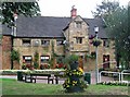
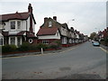
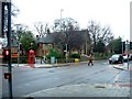
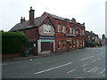
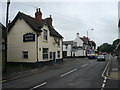
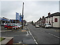
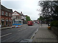
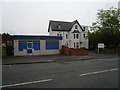
Photos of DE55 7BX


Area Information
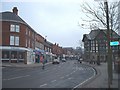
Living in DE55 7BX offers a quiet, residential lifestyle in a small cluster of homes with a population of 1984. The area is characterised by a mature demographic, with a median age of 47 and most residents falling within the 30-64 age range. This suggests a stable, community-oriented environment where many households are long-established. The area is primarily composed of owner-occupied homes, with 69% of properties owned by residents, and the accommodation type is predominantly houses rather than flats. Proximity to Alfreton Railway Station and nearby schools adds practical convenience. Broadband connectivity is excellent, scoring 98 out of 100, supporting remote work and daily internet needs. While the area lacks large-scale amenities, its compact size ensures a close-knit feel, with local shops and rail links providing essential access. For those seeking a low-maintenance, family-friendly setting with good infrastructure, DE55 7BX presents a straightforward option.
- Area Type
- Postcode
- Area Size
- Not available
- Population
- 1984
- Population Density
- 2208 people/km²
The property market in DE55 7BX is dominated by owner-occupied homes, with 69% of properties owned by residents. This suggests a stable market with limited rental activity, as the area is not primarily a rental hub. The accommodation type is exclusively houses, which is uncommon in smaller postcode areas, indicating a focus on single-family homes. Given the small population and compact size of the area, the housing stock is likely limited, with little scope for new developments. Buyers should consider the local market’s constraints, as demand may outstrip supply. The presence of nearby rail links and schools adds appeal for families, but the area’s small size means properties are likely to be in close proximity to one another.
House Prices in DE55 7BX
No properties found in this postcode.
Energy Efficiency in DE55 7BX
The lifestyle in DE55 7BX is shaped by its proximity to local amenities, including retail options such as Tesco Alfreton, Farmfoods Alfreton, and Lidl Alfreton. These stores provide access to groceries and everyday essentials, reducing the need for long journeys. The area’s rail links, including Alfreton Railway Station, offer convenient travel to nearby destinations, enhancing connectivity for shopping, work, or leisure. While the area lacks large parks or leisure facilities, the nearby schools and retail options contribute to a practical, community-focused lifestyle. The compact nature of the postcode means amenities are within practical reach, supporting a low-maintenance, self-contained way of living.
Amenities
Schools
Residents of DE55 7BX have access to a range of schools, including Alfreton Nursery School for early years education and Woodbridge Junior School, which holds a ‘good’ Ofsted rating. Alfreton Grange Arts College and David Nieper Academy, both rated ‘good’, provide primary education options, while Watchorn Christian School, an independent institution also rated ‘good’, offers an alternative for families seeking non-state schooling. The mix of state and independent schools ensures flexibility for parents, with multiple high-quality options within reach. This diversity supports families with varying educational preferences, from traditional state schools to private institutions. The presence of multiple schools rated ‘good’ by Ofsted indicates a generally strong educational environment for children in the area.
| Rank | School | Type | Entry gender | Ages |
|---|
Explore more schools in this area
Go to Schools tabDemographics
The community in DE55 7BX is largely composed of adults aged 30-64, reflecting a median age of 47. This age profile suggests a population that is settled, with fewer young families or elderly residents compared to other areas. Home ownership is high, with 69% of properties owned by residents, indicating a stable housing market. The accommodation is exclusively houses, with no flats or apartments present. The predominant ethnic group is White, though specific data on diversity is not provided. The absence of detailed deprivation statistics means the area’s quality of life cannot be assessed in that regard, but the high home ownership rate and mature demographic suggest a relatively affluent, low-turnover community.
Household Size
Accommodation Type
Tenure
Ethnic Group
Religion
Household Composition
Age
Household Deprivation
NS-SEC
Explore more demographic insights in this area
Go to Demographics tabPlanning
Planning Constraints
- Flood RiskPremium
- Ramsar Wetland SitesPremium
- Area of Outstanding Natural BeautyPremium
- Protected Nature ReservePremium
- Protected WoodlandPremium