Area Overview for DE55 6ZA
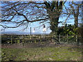
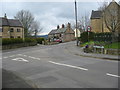
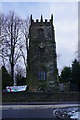
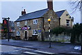
Photos of DE55 6ZA


Area Information
Living in DE55 6ZA means inhabiting a compact, residential cluster in England with a population of 1650 people spread over a densely populated area, at 786 people per square kilometre. This postcode is characterised by a mature community, with a median age of 47 and a majority of residents aged between 30 and 64. The area is largely composed of houses, with 51% of properties owner-occupied, suggesting a stable, long-term demographic. Daily life here is shaped by proximity to essential services and transport links. Residents benefit from nearby rail stations, including Alfreton and Whatstandwell, which connect to broader regional networks. The area’s small scale means a tight-knit feel, though it remains practical for those needing access to retail, education, and employment. For buyers, DE55 6ZA offers a blend of traditional housing and accessibility, though its limited size means the immediate surroundings are key to understanding its full appeal.
- Area Type
- Postcode
- Area Size
- Not available
- Population
- 1650
- Population Density
- 786 people/km²
The property market in DE55 6ZA is defined by its housing stock, which is predominantly houses, with 51% of properties owner-occupied. This suggests a balance between private ownership and rental availability, though the area’s small size means the market is not expansive. The concentration of houses implies a focus on family homes, which may appeal to buyers seeking traditional layouts. However, the limited scale of the postcode means the immediate surrounding areas are critical for property options. Buyers should consider the area’s compact nature and proximity to amenities like rail stations and retail hubs. The market is likely to cater more to owner-occupiers than investors, given the demographic profile and housing type.
House Prices in DE55 6ZA
No properties found in this postcode.
Energy Efficiency in DE55 6ZA
The lifestyle in DE55 6ZA is shaped by its proximity to retail and transport hubs. Nearby shops include Asda Adastra, Farmfoods Alfreton, and Spar, offering everyday essentials within practical reach. These retail options support convenience for residents, reducing the need for long trips. The area’s rail stations connect to broader networks, enhancing accessibility for both leisure and work. While the data does not specify parks or leisure facilities, the presence of retail and transport infrastructure suggests a functional, community-oriented environment. The compact nature of the postcode means amenities are closely clustered, fostering a sense of ease in daily life.
Amenities
Schools
The nearest school to DE55 6ZA is Mickley Village Primary & Nursery School, a primary institution with an Ofsted rating of satisfactory. This school serves the local community, offering education for younger children. The absence of secondary schools or additional educational institutions in the data means families may need to look beyond the immediate area for comprehensive schooling. However, the presence of a primary school within reach is a practical advantage for parents, reducing the need for long commutes. The satisfactory rating indicates that the school meets basic standards, though further details on performance or facilities are not available.
| Rank | School | Type | Entry gender | Ages |
|---|
Explore more schools in this area
Go to Schools tabDemographics
DE55 6ZA’s population is predominantly adults aged 30 to 64, with a median age of 47, indicating a community skewed towards middle-aged residents. The area’s home ownership rate is 51%, suggesting a mix of owner-occupied and rental properties. Accommodation is largely composed of houses, reflecting a preference for single-family living. The predominant ethnic group is White, though no specific data on diversity or deprivation is provided. This age profile suggests a stable population, likely with established careers and families. The absence of detailed diversity metrics means broader demographic insights remain limited, but the data highlights a community focused on long-term residency rather than transient populations.
Household Size
Accommodation Type
Tenure
Ethnic Group
Religion
Household Composition
Age
Household Deprivation
NS-SEC
Explore more demographic insights in this area
Go to Demographics tabPlanning
Planning Constraints
- Flood RiskPremium
- Ramsar Wetland SitesPremium
- Area of Outstanding Natural BeautyPremium
- Protected Nature ReservePremium
- Protected WoodlandPremium