Area Overview for DE55 5NQ
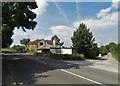
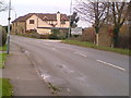
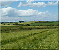
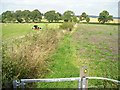
Photos of DE55 5NQ


Area Information
Living in DE55 5NQ offers a compact, residential experience shaped by its small size and close-knit character. The area covers just 2.6 hectares, housing 1,759 residents in a densely populated setting of 761 people per square kilometre. This postcode cluster is defined by its proximity to key transport links and local amenities, making it practical for daily life. The community leans towards middle-aged adults, with a median age of 47 and most residents falling between 30 and 64 years. Home ownership is high at 75%, with traditional houses dominating the housing stock. While the area lacks natural conservation designations, its accessibility to rail networks and retail hubs like Co-op Tibshelf and Tesco Huthwaite ensures convenience. DE55 5NQ is not a sprawling suburb but a tightly woven neighbourhood where proximity to services and transport is a defining feature. For buyers, it represents a balance between residential tranquillity and functional connectivity, though its small size means the immediate surroundings hold the bulk of available options.
- Area Type
- Postcode
- Area Size
- 2.6 hectares
- Population
- 1759
- Population Density
- 761 people/km²
DE55 5NQ is a predominantly owner-occupied area, with 75% of residents living in homes they own. The housing stock is almost entirely composed of houses, rather than flats or rental properties, which suggests a market tailored to established families and long-term residents. This contrasts with areas where rental demand drives property types. The small size of the postcode means the immediate surrounding areas hold the majority of available properties, creating a limited but focused market. Buyers should expect a mix of traditional homes, likely with gardens and fixed layouts, reflecting the age profile of the community. The high home ownership rate indicates a stable market with less speculative investment, though the small area size may limit options for those seeking larger or newer properties. For those prioritising security and local ties, DE55 5NQ offers a straightforward, low-turnover environment.
House Prices in DE55 5NQ
No properties found in this postcode.
Energy Efficiency in DE55 5NQ
Residents of DE55 5NQ have access to essential retail and transport hubs within practical reach. Local shops include Spar, Co-op Tibshelf, and Tesco Huthwaite, offering everyday groceries and services. These stores cater to the needs of a mature, stable community, with a focus on convenience rather than large-scale retail. The area’s rail stations—Alfreton, Sutton Parkway, and Kirkby in Ashfield—provide direct links to regional centres, enhancing mobility for work, leisure, or shopping. While the data does not mention parks or leisure facilities, the absence of protected natural areas suggests a focus on built environments. The compact layout means amenities are closely grouped, reducing travel time for daily errands. For those valuing proximity to services and transport, DE55 5NQ offers a functional lifestyle with minimal need to venture far for essentials.
Amenities
Schools
| Rank | School | Type | Entry gender | Ages |
|---|
Explore more schools in this area
Go to Schools tabDemographics
The population of DE55 5NQ is predominantly composed of adults aged 30 to 64, reflecting a mature, stable community. With a median age of 47, the area is less populated by younger families or retirees compared to other regions. Home ownership is strong, at 75%, suggesting long-term residency and investment in property. The housing stock is almost entirely made up of houses, rather than flats or apartments, which aligns with the demographic profile of established households. The predominant ethnic group is White, though no specific data on diversity or deprivation is provided. The high population density—761 people per square kilometre—means the area is compact, with limited open space. This density, combined with the age profile, indicates a community focused on stability and local amenities rather than rapid growth or change. For prospective buyers, the demographic makeup suggests a low turnover of properties and a market driven by long-term residents seeking secure, family-oriented homes.
Household Size
Accommodation Type
Tenure
Ethnic Group
Religion
Household Composition
Age
Household Deprivation
NS-SEC
Explore more demographic insights in this area
Go to Demographics tabPlanning
Planning Constraints
- Flood RiskPremium
- Ramsar Wetland SitesPremium
- Area of Outstanding Natural BeautyPremium
- Protected Nature ReservePremium
- Protected WoodlandPremium