Area Overview for DE55 4SW
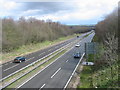
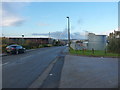
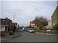
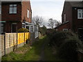
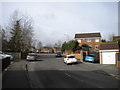
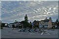
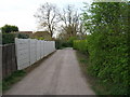
Photos of DE55 4SW


Area Information
DE55 4SW is a small, tightly knit residential postcode area in England, covering just 2.5 hectares. With a population of 1,333 people and a density of 760 residents per square kilometre, it is a compact community where most homes are owner-occupied. The area’s size means it is not a sprawling suburb but a focused cluster of housing, likely centred around local amenities and transport links. Daily life here is shaped by proximity to essential services, with residents walking or cycling short distances to shops, schools, and rail stations. The median age of 47 suggests a stable, mature population, many of whom are likely long-term residents. While the area lacks large-scale infrastructure, its small footprint ensures a quiet, manageable lifestyle. For buyers, DE55 4SW offers a snapshot of traditional English suburbia: modest homes, a sense of familiarity, and a community defined by its immediate surroundings. The absence of major planning constraints or environmental protections means development is unlikely to disrupt the existing character. This is a place where practicality and simplicity are prioritised over grandeur.
- Area Type
- Postcode
- Area Size
- 2.5 hectares
- Population
- 1333
- Population Density
- 760 people/km²
DE55 4SW is a predominantly owner-occupied area, with 65% of homes owned by their residents. The accommodation type is exclusively houses, which is unusual for a postcode of this size but suggests a focus on single-family dwellings. Given the area’s small footprint of 2.5 hectares, the housing stock is likely limited to a few dozen properties, each occupying substantial plots. This contrasts with areas dominated by flats or terraced housing, where density is higher. For buyers, this means the market is not large, and properties are likely to be in established, traditional styles. The lack of rental data implies that the area is not a hotspot for investors or tenants, making it more appealing to those seeking a long-term home. The small size of the area also means that buyers must consider the immediate surroundings for additional housing options. The predominance of owner-occupation suggests a community of settled residents, which can be a draw for those seeking stability.
House Prices in DE55 4SW
Showing 1 properties
| Address | Type | Beds | Baths | Last Sale Price | Last Sale Date | |
|---|---|---|---|---|---|---|
| Grange Close Entrance, Slimming World, Clover Nook Road, South Normanton, DE55 4SW | warehouse | - | - | - | - |
Energy Efficiency in DE55 4SW
Residents of DE55 4SW have access to a range of nearby amenities, including five retail outlets such as Morrisons Daily, Co-op Somercotes, and Aldi Somercotes. These stores provide essential shopping options for groceries, household goods, and daily needs. The area’s rail network, with stations like Alfreton and Sutton Parkway, adds convenience for commuting or travel beyond the immediate postcode. While the data does not mention parks or leisure facilities, the proximity to rail stations and retail hubs suggests a lifestyle focused on practicality and connectivity. The small size of the area means that most amenities are within walking distance, reducing the need for a car. For those who prefer to dine out, the retail presence implies a selection of local eateries or cafes, though specific names are not listed. The combination of shops, rail links, and a compact footprint creates a self-contained environment where daily life is efficient and accessible.
Amenities
Schools
Residents of DE55 4SW have access to two primary schools within practical reach. Longwood Community Infant School is a standard primary institution, while Longwood Infant Academy is an academy with an outstanding Ofsted rating. The presence of both a traditional school and an academy provides families with choice, though the academy’s high rating suggests it may be a key draw for parents seeking quality education. The area’s small size means these schools serve a local catchment area, likely including nearby postcodes. For families, this combination of options ensures that children can attend either a conventional school or one with a strong performance record. The absence of secondary schools in the data means parents may need to look further afield for older children, but the proximity to rail stations could ease this challenge. The schools’ presence reinforces the area’s appeal to households prioritising education.
| Rank | School | Type | Entry gender | Ages |
|---|
Explore more schools in this area
Go to Schools tabDemographics
The population of DE55 4SW is predominantly adults aged 30–64, with a median age of 47. This suggests a community of working-age individuals and families, many of whom may be raising children in the area. Home ownership is high at 65%, indicating a strong presence of long-term residents who have invested in property. The accommodation type is primarily houses, which aligns with the area’s low density and residential focus. The predominant ethnic group is White, though no specific data on diversity or deprivation is provided. The age profile implies a balance between established households and younger families, though the absence of data on younger demographics or student populations means the community’s full composition remains unclear. With no mention of social housing or rental properties, the area appears to cater more to owner-occupiers than tenants. This demographic profile suggests a stable, low-turnover environment where residents are likely to remain for extended periods.
Household Size
Accommodation Type
Tenure
Ethnic Group
Religion
Household Composition
Age
Household Deprivation
NS-SEC
Explore more demographic insights in this area
Go to Demographics tabPlanning
Planning Constraints
- Flood RiskPremium
- Ramsar Wetland SitesPremium
- Area of Outstanding Natural BeautyPremium
- Protected Nature ReservePremium
- Protected WoodlandPremium