Area Overview for DE55 4SD
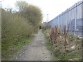
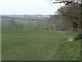
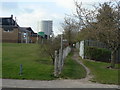
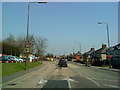
Photos of DE55 4SD


Area Information
Living in DE55 4SD means inhabiting a small, tightly knit residential cluster in England’s East Midlands. With a population of 1,854 spread across 725 people per square kilometre, this area balances compact living with access to nearby amenities. The community is characterised by a mature demographic, with a median age of 47 and a majority of residents aged 30–64. Daily life here revolves around local shops, rail links, and family-oriented routines. The proximity to Ripley St John’s Church of England Primary School, rated ‘good’ by Ofsted, ensures children have access to quality education within walking distance. While the area lacks sprawling green spaces or major landmarks, its practicality is evident in the availability of essential services. Residents benefit from strong digital connectivity and multiple railway stations, making it a viable choice for commuters. However, the small size of DE55 4SD means its housing stock is limited, requiring buyers to consider nearby areas for broader options.
- Area Type
- Postcode
- Area Size
- Not available
- Population
- 1854
- Population Density
- 725 people/km²
DE55 4SD is primarily an owner-occupied area, with 70% of homes owned by residents rather than rented. The accommodation type is predominantly houses, which suggests a focus on family homes and long-term residency. This contrasts with areas dominated by rental properties or apartments, where turnover is higher. The small size of the postcode means the housing stock is limited, making it a niche market for buyers seeking established properties. Those considering the area should be aware that the immediate surroundings may offer more options, as the cluster of homes within DE55 4SD is relatively compact. The emphasis on houses also implies that properties may be larger than average, appealing to those prioritising space over convenience in a densely populated region.
House Prices in DE55 4SD
No properties found in this postcode.
Energy Efficiency in DE55 4SD
Residents of DE55 4SD have access to a range of retail and transport amenities within practical reach. Local shops include Tesco Codnor, Sainsburys Ripley, and Farmfoods Marehay, providing everyday essentials without the need for long journeys. The area’s railway stations—Langley Mill, Alfreton, and Ambergate—offer connections to broader networks, facilitating travel to larger towns. While the data does not mention parks or leisure facilities, the presence of multiple retail outlets and rail links suggests a focus on convenience over expansive recreational spaces. The mix of shops and transport options supports a practical lifestyle, ideal for those prioritising accessibility over large-scale amenities.
Amenities
Schools
The nearest school to DE55 4SD is Ripley St John’s Church of England Primary School and Nursery, which provides education for younger children. Rated ‘good’ by Ofsted, it offers a reliable option for families within the area. The absence of secondary schools nearby means students may need to commute to neighbouring towns, but the primary school’s quality ensures a solid foundation for early education. For parents, the school’s rating and proximity are significant advantages, reducing the need for long-distance travel. The single school listed in the data suggests a limited range of educational choices, which could be a consideration for families requiring specialist provisions or larger institutions.
| Rank | School | Type | Entry gender | Ages |
|---|---|---|---|---|
| 1 | Ripley St John's Church of England Primary School and Nursery | primary | N/A | N/A |
Explore more schools in this area
Go to Schools tabDemographics
DE55 4SD’s population is predominantly middle-aged, with a median age of 47 and 70% of residents owning their homes. The area is dominated by adults aged 30–64, reflecting a stable, family-oriented community. Accommodation is largely composed of houses, aligning with the 70% home ownership rate, which suggests a long-term presence of residents. The predominant ethnic group is White, with no data indicating significant diversity beyond this. The demographic profile implies a low turnover of residents, fostering a sense of continuity. However, the absence of specific data on deprivation or income levels means the area’s economic resilience remains unquantified. For buyers, this stability may translate to predictable property values but could also limit opportunities for younger or more transient populations seeking different lifestyles.
Household Size
Accommodation Type
Tenure
Ethnic Group
Religion
Household Composition
Age
Household Deprivation
NS-SEC
Explore more demographic insights in this area
Go to Demographics tabPlanning
Planning Constraints
- Flood RiskPremium
- Ramsar Wetland SitesPremium
- Area of Outstanding Natural BeautyPremium
- Protected Nature ReservePremium
- Protected WoodlandPremium
- Crime RiskPremium