Area Overview for DE55 4PL
Photos of DE55 4PL


Area Information
Living in DE55 4PL means inhabiting a compact, residential cluster in England’s East Midlands. The area spans just 2.2 hectares, housing 1,398 people in a densely populated 886 people per square kilometre. This small postcode is defined by its proximity to local schools, rail links, and retail hubs, making it practical for daily life. The community is predominantly composed of adults aged 30–64, with a median age of 47, suggesting a mature, stable population. While the area lacks expansive green spaces or natural landmarks, its accessibility to nearby amenities and transport networks offsets this. Residents benefit from a mix of retail options and rail stations within reach, supporting a lifestyle that balances convenience with a sense of locality. The compact size means the area feels cohesive, with residents likely to know their neighbours. However, the high population density and limited space may pose challenges for those seeking larger properties or open spaces. For buyers prioritising proximity to schools and transport, DE55 4PL offers a functional, if modest, living environment.
- Area Type
- Postcode
- Area Size
- 2.2 hectares
- Population
- 1398
- Population Density
- 886 people/km²
The property market in DE55 4PL is characterised by a 46% home ownership rate, with houses making up the majority of accommodation types. This suggests a focus on owner-occupied properties, though the relatively low home ownership rate implies a notable rental market. Given the area’s small size and high population density, housing stock is likely limited, with properties concentrated in a tight radius. The prevalence of houses may indicate a mix of family homes and semi-detached properties, but the lack of specific data on property types or sizes means buyers must consider the area’s constraints. The compact nature of DE55 4PL means that properties are likely to be close to local amenities, which is a plus for those prioritising convenience. However, the limited space may restrict options for larger homes or those seeking more private outdoor areas. Buyers should also consider the proximity to schools and transport, which could enhance the area’s appeal despite its small footprint.
House Prices in DE55 4PL
No properties found in this postcode.
Energy Efficiency in DE55 4PL
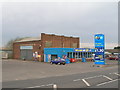
Daily life in DE55 4PL is shaped by its proximity to essential amenities within walking or short driving distance. Retail options include Aldi Somercotes, Iceland Alfreton, and Co-op Somercotes, offering a range of grocery and household goods. These shops support a practical lifestyle, reducing the need for long trips to larger centres. The area also benefits from multiple rail stations, including Alfreton and Ambergate, which connect residents to broader networks for commuting or leisure. While the data does not mention parks or leisure facilities, the presence of schools and retail suggests a focus on family and daily convenience. The compact nature of the area means residents can access essentials without excessive travel, though larger recreational spaces may require venturing further afield. The mix of retail, transport, and educational facilities creates a self-contained environment, ideal for those prioritising proximity to services over expansive open spaces.
Amenities
Schools
Residents of DE55 4PL have access to a range of primary and academy schools, including Somerlea Park Junior School, Somercotes Infant School, and Somercotes Infant and Nursery School, which is an academy rated ‘good’ by Ofsted. Additionally, Somerlea Park Junior School operates as an academy with the same ‘good’ rating. This mix of school types offers families options between traditional state schools and academies, both of which are performing well. The presence of a nursery school suggests the area caters to younger families, while the primary schools provide a structured educational environment. The proximity of these schools to the postcode area makes them practical for daily commutes, reducing the need for long journeys. The ‘good’ Ofsted ratings indicate a generally reliable standard of education, though specific performance metrics are not detailed. For families prioritising school quality, DE55 4PL’s options are a significant advantage.
| Rank | School | Type | Entry gender | Ages |
|---|
Explore more schools in this area
Go to Schools tabDemographics
DE55 4PL’s population is largely composed of adults aged 30–64, with a median age of 47. This suggests a community of established professionals and families, rather than a mix of younger or older demographics. Home ownership stands at 46%, with houses being the predominant accommodation type. This indicates a mix of owner-occupied properties and rental units, though the lower home ownership rate implies a significant portion of residents may be renting. The predominant ethnic group is White, with no data provided on other ethnicities. The population density of 886 people per square kilometre reflects a tightly packed residential area, which may influence the character of the neighbourhood. For quality of life, the high population density could mean limited private outdoor space, but the proximity to schools, retail, and rail links compensates. The data does not indicate deprivation levels, but the mix of age groups and housing types suggests a balanced, if compact, community.
Household Size
Accommodation Type
Tenure
Ethnic Group
Religion
Household Composition
Age
Household Deprivation
NS-SEC
Explore more demographic insights in this area
Go to Demographics tabPlanning
Planning Constraints
- Flood RiskPremium
- Ramsar Wetland SitesPremium
- Area of Outstanding Natural BeautyPremium
- Protected Nature ReservePremium
- Protected WoodlandPremium