Area Overview for DE55 4NW
Photos of DE55 4NW
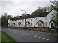
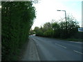
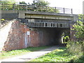
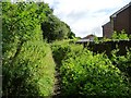

10 photos from this area
Area Information
Key information about the DE55 4NW including its size, population, and administrative classification.
- Area Type
- Postcode
- Area Size
- 38.4 hectares
- Population
- 1477
- Population Density
- 434 people/km²
House Prices in DE55 4NW
29
Properties
£145,958
Average Sold Price
£19,500
Lowest Price
£325,000
Highest Price
Showing 29 properties
| Address | Type | Beds | Baths | Last Sale Price | Last Sale Date | |
|---|---|---|---|---|---|---|
| 26 Main Road, Pye Bridge, Alfreton, DE55 4NW | Terraced | 2 | 1 | £130,000 | Oct 2025 | |
| 28 Main Road, Pye Bridge, Alfreton, DE55 4NW | Retail | 2 | 2 | £115,000 | Aug 2022 | |
| Station House, Main Road, Pye Bridge, Alfreton, DE55 4NW | Retail | 3 | 2 | £325,000 | May 2022 | |
| 16 Main Road, Pye Bridge, Alfreton, DE55 4NW | Semi-detached | 2 | 1 | £160,000 | Oct 2021 | |
| 32A Main Road, Pye Bridge, Alfreton, DE55 4NW | Semi-detached | 3 | - | £140,000 | Oct 2021 | |
| 30 Main Road, Pye Bridge, Alfreton, DE55 4NW | Terraced | 2 | - | £120,000 | Sep 2021 | |
| 14 Main Road, Pye Bridge, Alfreton, DE55 4NW | house | - | - | £250,000 | Oct 2020 | |
| 70 Main Road, Pye Bridge, Alfreton, DE55 4NW | Semi-detached | 3 | 1 | £138,000 | Nov 2019 | |
| 31A Main Road, Pye Bridge, Alfreton, DE55 4NW | Semi-detached | 3 | - | £85,000 | Oct 2017 | |
| 22 Main Road, Pye Bridge, Alfreton, DE55 4NW | house | 2 | - | £85,000 | Sep 2016 |
Page 1 of 3
Energy Efficiency in DE55 4NW
Amenities
Schools
| Rank | School | Type | Entry gender | Ages |
|---|
Explore more schools in this area
Go to Schools tabDemographics
Household Size
Two person
most common
Accommodation Type
Houses
most common
Tenure
62
majority
Ethnic Group
White
most common
Religion
N/A
most common
Household Composition
N/A
most common
Age
47
median
Adults (30-64 years)
most common
Household Deprivation
N/A
with no deprivation
NS-SEC
22
in Lower managerial occupations
Explore more demographic insights in this area
Go to Demographics tabPlanning
Planning Constraints
- Flood RiskPremium
- Ramsar Wetland SitesPremium
- Area of Outstanding Natural BeautyPremium
- Protected Nature ReservePremium
- Protected WoodlandPremium