Area Overview for DE55 4EQ
Photos of DE55 4EQ

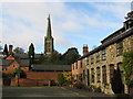
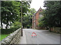
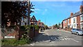
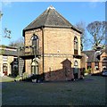
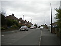
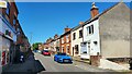
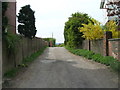
33 photos from this area
Area Information
Key information about the DE55 4EQ including its size, population, and administrative classification.
- Area Type
- Postcode
- Area Size
- 19.3 hectares
- Population
- 1708
- Population Density
- 2124 people/km²
House Prices in DE55 4EQ
66
Properties
£141,590
Average Sold Price
£32,000
Lowest Price
£320,000
Highest Price
Showing 66 properties
| Address | Type | Beds | Baths | Last Sale Price | Last Sale Date | |
|---|---|---|---|---|---|---|
| 1 Richardsons Lane, Riddings, Alfreton, DE55 4EQ | Bungalow | 2 | 1 | £230,000 | Jun 2025 | |
| 42 Newlands Road, Riddings, Alfreton, DE55 4EQ | Semi-detached | 3 | 1 | £220,000 | Nov 2024 | |
| 4 Newlands Road, Riddings, Alfreton, DE55 4EQ | house | 1 | 1 | £245,000 | Sep 2024 | |
| 10 Newlands Road, Riddings, Alfreton, DE55 4EQ | house | - | - | £155,850 | Apr 2024 | |
| 32 Newlands Road, Riddings, Alfreton, DE55 4EQ | house | - | - | £275,000 | Mar 2024 | |
| 6 Newlands Road, Riddings, Alfreton, DE55 4EQ | Semi-detached | 3 | 1 | £170,000 | Feb 2024 | |
| 65 Newlands Road, Riddings, Alfreton, DE55 4EQ | Semi-detached | 3 | 2 | £160,000 | Oct 2020 | |
| 12 Newlands Road, Riddings, Alfreton, DE55 4EQ | Detached | 3 | - | £211,500 | Nov 2018 | |
| 16 Newlands Road, Riddings, Alfreton, DE55 4EQ | Semi-detached | 3 | 1 | £150,500 | Oct 2018 | |
| 17 Newlands Road, Riddings, Alfreton, DE55 4EQ | Terraced | 3 | 1 | £125,000 | Jul 2018 |
Page 1 of 7
Energy Efficiency in DE55 4EQ
Amenities
Schools
| Rank | School | Type | Entry gender | Ages |
|---|
Explore more schools in this area
Go to Schools tabDemographics
Household Size
Two person
most common
Accommodation Type
Houses
most common
Tenure
76
majority
Ethnic Group
White
most common
Religion
N/A
most common
Household Composition
N/A
most common
Age
47
median
Adults (30-64 years)
most common
Household Deprivation
N/A
with no deprivation
NS-SEC
26
in Lower managerial occupations
Explore more demographic insights in this area
Go to Demographics tabPlanning
Planning Constraints
- Flood RiskPremium
- Ramsar Wetland SitesPremium
- Area of Outstanding Natural BeautyPremium
- Protected Nature ReservePremium
- Protected WoodlandPremium