Area Overview for DE55 4AE
Photos of DE55 4AE
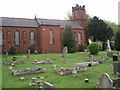
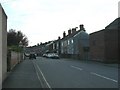
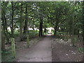

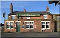

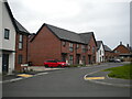
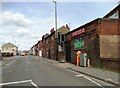
34 photos from this area
Area Information
Key information about the DE55 4AE including its size, population, and administrative classification.
- Area Type
- Postcode
- Area Size
- 2.8 hectares
- Population
- 1708
- Population Density
- 2124 people/km²
House Prices in DE55 4AE
47
Properties
£149,457
Average Sold Price
£45,000
Lowest Price
£295,000
Highest Price
Showing 47 properties
| Address | Type | Beds | Baths | Last Sale Price | Last Sale Date | |
|---|---|---|---|---|---|---|
| 62 Pennine Avenue, Riddings, Alfreton, DE55 4AE | Bungalow | - | - | £272,000 | Dec 2022 | |
| 36 Pennine Avenue, Riddings, Alfreton, DE55 4AE | Retail | 2 | 1 | £204,950 | Apr 2022 | |
| 59 Pennine Avenue, Riddings, Alfreton, DE55 4AE | Bungalow | - | - | £170,000 | Oct 2021 | |
| 37 Pennine Avenue, Riddings, Alfreton, DE55 4AE | house | - | - | £295,000 | Jun 2021 | |
| 39 Pennine Avenue, Riddings, Alfreton, DE55 4AE | Detached | 3 | - | £215,000 | Mar 2021 | |
| 30 Pennine Avenue, Riddings, Alfreton, DE55 4AE | Bungalow | - | - | £160,000 | Dec 2020 | |
| 46 Pennine Avenue, Riddings, Alfreton, DE55 4AE | Bungalow | 2 | - | £250,000 | Sep 2020 | |
| 61 Pennine Avenue, Riddings, Alfreton, DE55 4AE | Bungalow | 2 | - | £190,000 | Jul 2018 | |
| 25 Pennine Avenue, Riddings, Alfreton, DE55 4AE | house | - | - | £150,000 | Mar 2018 | |
| 23 Pennine Avenue, Riddings, Alfreton, DE55 4AE | house | - | - | £245,000 | Sep 2016 |
Page 1 of 5
Energy Efficiency in DE55 4AE
Amenities
Schools
| Rank | School | Type | Entry gender | Ages |
|---|
Explore more schools in this area
Go to Schools tabDemographics
Household Size
Two person
most common
Accommodation Type
Houses
most common
Tenure
76
majority
Ethnic Group
White
most common
Religion
N/A
most common
Household Composition
N/A
most common
Age
47
median
Adults (30-64 years)
most common
Household Deprivation
N/A
with no deprivation
NS-SEC
26
in Lower managerial occupations
Explore more demographic insights in this area
Go to Demographics tabPlanning
Planning Constraints
- Flood RiskPremium
- Ramsar Wetland SitesPremium
- Area of Outstanding Natural BeautyPremium
- Protected Nature ReservePremium
- Protected WoodlandPremium