Area Overview for DE55 3DH
Photos of DE55 3DH


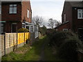
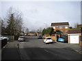

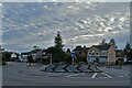
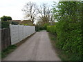
17 photos from this area
Area Information
Key information about the DE55 3DH including its size, population, and administrative classification.
- Area Type
- Postcode
- Area Size
- 1.0 hectares
- Population
- 1822
- Population Density
- 4325 people/km²
House Prices in DE55 3DH
19
Properties
£179,013
Average Sold Price
£135,000
Lowest Price
£253,000
Highest Price
Showing 19 properties
| Address | Type | Beds | Baths | Last Sale Price | Last Sale Date | |
|---|---|---|---|---|---|---|
| 12 Carnfield Close, South Normanton, DE55 3DH | Semi-detached | 4 | 3 | £220,000 | Apr 2024 | |
| 2 Carnfield Close, South Normanton, DE55 3DH | Semi-detached | 4 | 2 | £240,000 | Feb 2023 | |
| 20 Carnfield Close, South Normanton, DE55 3DH | house | - | - | £181,000 | Jul 2021 | |
| 5 Carnfield Close, South Normanton, DE55 3DH | house | - | - | £253,000 | Jun 2021 | |
| 24 Carnfield Close, South Normanton, DE55 3DH | Semi-detached | 4 | - | £185,000 | May 2021 | |
| 26 Carnfield Close, South Normanton, DE55 3DH | Semi-detached | 4 | - | £175,000 | Jul 2019 | |
| 3 Carnfield Close, South Normanton, DE55 3DH | Semi-detached | 4 | 3 | £175,750 | Jan 2019 | |
| 1 Carnfield Close, South Normanton, DE55 3DH | Semi-detached | 4 | 2 | £167,000 | Jul 2017 | |
| 6 Carnfield Close, South Normanton, DE55 3DH | house | - | - | £248,000 | Oct 2016 | |
| 10 Carnfield Close, South Normanton, DE55 3DH | Semi-detached | 4 | 2 | £160,000 | Apr 2016 |
Page 1 of 2
Energy Efficiency in DE55 3DH
Amenities
Schools
| Rank | School | Type | Entry gender | Ages |
|---|
Explore more schools in this area
Go to Schools tabDemographics
Household Size
Two person
most common
Accommodation Type
Houses
most common
Tenure
65
majority
Ethnic Group
White
most common
Religion
N/A
most common
Household Composition
N/A
most common
Age
47
median
Adults (30-64 years)
most common
Household Deprivation
N/A
with no deprivation
NS-SEC
25
in Lower managerial occupations
Explore more demographic insights in this area
Go to Demographics tabPlanning
Planning Constraints
- Flood RiskPremium
- Ramsar Wetland SitesPremium
- Area of Outstanding Natural BeautyPremium
- Protected Nature ReservePremium
- Protected WoodlandPremium