Area Overview for DE55 3AY
Photos of DE55 3AY
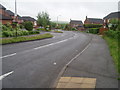
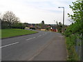
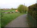
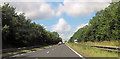

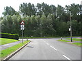
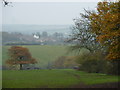
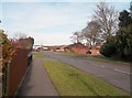
13 photos from this area
Area Information
Key information about the DE55 3AY including its size, population, and administrative classification.
- Area Type
- Postcode
- Area Size
- 4627 m²
- Population
- 1677
- Population Density
- 3062 people/km²
House Prices in DE55 3AY
10
Properties
£174,431
Average Sold Price
£71,950
Lowest Price
£293,000
Highest Price
Showing 10 properties
| Address | Type | Beds | Baths | Last Sale Price | Last Sale Date | |
|---|---|---|---|---|---|---|
| 3 Long Sleets, Broadmeadows, Pinxton, DE55 3AY | house | 4 | 1 | £287,500 | Sep 2023 | |
| 2 Long Sleets, Broadmeadows, Pinxton, DE55 3AY | Detached | 4 | 2 | £293,000 | Mar 2022 | |
| 8 Long Sleets, Broadmeadows, Pinxton, DE55 3AY | Detached | 3 | 2 | £184,460 | Aug 2018 | |
| 1 Long Sleets, Broadmeadows, Pinxton, DE55 3AY | house | - | - | £180,000 | Jul 2016 | |
| 4 Long Sleets, Broadmeadows, Pinxton, DE55 3AY | house | - | - | £150,000 | Aug 2014 | |
| 9 Long Sleets, Broadmeadows, Pinxton, DE55 3AY | house | - | - | £237,500 | Mar 2007 | |
| 7 Long Sleets, Broadmeadows, Pinxton, DE55 3AY | Detached | 4 | - | £169,950 | Aug 2005 | |
| 5 Long Sleets, Broadmeadows, Pinxton, DE55 3AY | Detached | - | - | £88,000 | Jun 2001 | |
| 6 Long Sleets, Broadmeadows, Pinxton, DE55 3AY | house | - | - | £71,950 | Jun 2000 | |
| 10 Long Sleets, Broadmeadows, Pinxton, DE55 3AY | house | - | - | £81,950 | Dec 1999 |
Energy Efficiency in DE55 3AY
Amenities
Schools
| Rank | School | Type | Entry gender | Ages |
|---|
Explore more schools in this area
Go to Schools tabDemographics
Household Size
Two person
most common
Accommodation Type
Houses
most common
Tenure
83
majority
Ethnic Group
White
most common
Religion
N/A
most common
Household Composition
N/A
most common
Age
47
median
Adults (30-64 years)
most common
Household Deprivation
N/A
with no deprivation
NS-SEC
31
in Lower managerial occupations
Explore more demographic insights in this area
Go to Demographics tabPlanning
Planning Constraints
- Flood RiskPremium
- Ramsar Wetland SitesPremium
- Area of Outstanding Natural BeautyPremium
- Protected Nature ReservePremium
- Protected WoodlandPremium