Area Overview for DE55 2WA
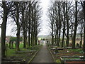
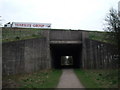
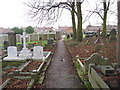
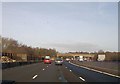
Photos of DE55 2WA


Area Information
Living in DE55 2WA offers a compact, residential experience shaped by its small cluster of homes and proximity to essential services. With a population of 1,659 people spread over a densely populated area—799 residents per square kilometre—the community feels close-knit yet functional. The area’s character is defined by its mix of everyday living, with local shops and rail links within practical reach. Residents here are predominantly middle-aged adults, many of whom own their homes. Daily life balances routine with access to nearby amenities, such as supermarkets and rail stations, which provide connectivity to wider regions. The absence of major environmental constraints, like protected woodlands or flood-prone zones, means the area is straightforward to navigate for new residents. While it lacks the vibrancy of larger towns, DE55 2WA offers a quiet, stable environment where practicality and convenience are prioritised. For those seeking a manageable, low-maintenance lifestyle with reliable access to transport and retail, this postcode area provides a solid foundation.
- Area Type
- Postcode
- Area Size
- Not available
- Population
- 1659
- Population Density
- 799 people/km²
The property market in DE55 2WA is characterised by a high rate of home ownership—77%—and a predominance of houses over flats. This suggests a market skewed towards owner-occupied properties, with fewer rental options available. The presence of houses rather than apartments indicates a focus on family-friendly, long-term living, which may appeal to buyers seeking spacious, stable homes. Given the area’s small size, the housing stock is likely limited, meaning buyers may need to consider nearby postcode areas for additional options. The high home ownership rate also implies a degree of price stability, as the market is less influenced by short-term rental demand. For prospective buyers, this means a focus on purchasing rather than renting, with properties likely to hold value over time. However, the limited scale of the area may mean fewer choices, requiring careful consideration of nearby locations for broader options.
House Prices in DE55 2WA
No properties found in this postcode.
Energy Efficiency in DE55 2WA
Residents of DE55 2WA have access to a range of local amenities that support everyday living. The area’s retail options include five nearby shops, such as Heron Hilcote, Co-op South, and Morrisons Daily, providing convenience for grocery shopping and other essentials. These stores cater to daily needs, reducing the necessity for long trips to larger centres. The presence of five rail stations, including Kirkby in Ashfield and Sutton Parkway, ensures easy access to public transport, enabling travel to nearby towns for work, leisure, or socialising. While the area lacks large-scale entertainment or green spaces, the proximity to rail links and local shops creates a functional lifestyle. The character of DE55 2WA is defined by its practicality—residents can meet most needs within walking distance or a short journey, fostering a self-contained, efficient community.
Amenities
Schools
| Rank | School | Type | Entry gender | Ages |
|---|
Explore more schools in this area
Go to Schools tabDemographics
The community in DE55 2WA is predominantly composed of adults aged 30–64, with a median age of 47. This suggests a mature population, likely with established careers and family ties. Home ownership is high, at 77%, indicating a strong presence of long-term residents who have invested in property. The area is primarily composed of houses, not flats, which aligns with the demographic profile of older, family-oriented households. The predominant ethnic group is White, reflecting a homogenous community. While this data does not provide specific figures on diversity, it implies a relatively uniform cultural landscape. The age distribution and ownership rates suggest a stable, low-turnover area where residents are likely to remain for extended periods. This stability can be advantageous for those seeking a consistent, predictable environment, though it may also limit the diversity of perspectives and experiences within the community.
Household Size
Accommodation Type
Tenure
Ethnic Group
Religion
Household Composition
Age
Household Deprivation
NS-SEC
Explore more demographic insights in this area
Go to Demographics tabPlanning
Planning Constraints
- Flood RiskPremium
- Ramsar Wetland SitesPremium
- Area of Outstanding Natural BeautyPremium
- Protected Nature ReservePremium
- Protected WoodlandPremium