Area Overview for DE55 2JE
Photos of DE55 2JE
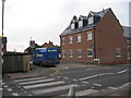
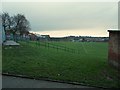

44 photos from this area
Area Information
Key information about the DE55 2JE including its size, population, and administrative classification.
- Area Type
- Postcode
- Area Size
- 1.8 hectares
- Population
- 1659
- Population Density
- 799 people/km²
House Prices in DE55 2JE
44
Properties
£106,095
Average Sold Price
£29,000
Lowest Price
£193,000
Highest Price
Showing 44 properties
| Address | Type | Beds | Baths | Last Sale Price | Last Sale Date | |
|---|---|---|---|---|---|---|
| 30 Corn Close, South Normanton, DE55 2JE | Detached | 2 | 1 | £190,000 | Dec 2025 | |
| 103 Corn Close, South Normanton, DE55 2JE | Bungalow | 2 | 1 | £135,000 | Mar 2025 | |
| 18 Corn Close, South Normanton, DE55 2JE | Bungalow | 2 | 1 | £180,000 | Oct 2024 | |
| 97 Corn Close, South Normanton, DE55 2JE | Bungalow | 2 | 1 | £170,000 | Jul 2024 | |
| 48 Corn Close, South Normanton, DE55 2JE | Bungalow | 2 | 1 | £193,000 | May 2023 | |
| 131 Corn Close, South Normanton, DE55 2JE | Bungalow | - | - | £150,000 | Sep 2021 | |
| 50 Corn Close, South Normanton, DE55 2JE | Bungalow | 2 | - | £126,000 | Mar 2020 | |
| 125 Corn Close, South Normanton, DE55 2JE | Bungalow | 2 | 1 | £121,000 | Mar 2019 | |
| 36 Corn Close, South Normanton, DE55 2JE | Bungalow | 2 | - | £134,000 | Oct 2018 | |
| 105 Corn Close, South Normanton, DE55 2JE | Detached | 2 | - | £118,000 | Mar 2018 |
Page 1 of 5
Energy Efficiency in DE55 2JE
Amenities
Schools
| Rank | School | Type | Entry gender | Ages |
|---|
Explore more schools in this area
Go to Schools tabDemographics
Household Size
Two person
most common
Accommodation Type
Houses
most common
Tenure
77
majority
Ethnic Group
White
most common
Religion
N/A
most common
Household Composition
N/A
most common
Age
47
median
Adults (30-64 years)
most common
Household Deprivation
N/A
with no deprivation
NS-SEC
30
in Lower managerial occupations
Explore more demographic insights in this area
Go to Demographics tabPlanning
Planning Constraints
- Flood RiskPremium
- Ramsar Wetland SitesPremium
- Area of Outstanding Natural BeautyPremium
- Protected Nature ReservePremium
- Protected WoodlandPremium