Area Overview for DE55 2DY
Photos of DE55 2DY

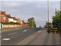

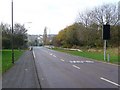
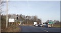
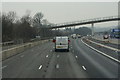


42 photos from this area
Area Information
Key information about the DE55 2DY including its size, population, and administrative classification.
- Area Type
- Postcode
- Area Size
- 8.1 hectares
- Population
- 1659
- Population Density
- 799 people/km²
House Prices in DE55 2DY
76
Properties
£91,282
Average Sold Price
£12,000
Lowest Price
£239,000
Highest Price
Showing 76 properties
| Address | Type | Beds | Baths | Last Sale Price | Last Sale Date | |
|---|---|---|---|---|---|---|
| 116 Carter Lane East, South Normanton, DE55 2DY | Semi-detached | 2 | 1 | £157,000 | Jul 2025 | |
| 130 Carter Lane East, South Normanton, DE55 2DY | Semi-detached | 3 | 1 | £140,000 | Jan 2025 | |
| 104 Carter Lane East, South Normanton, DE55 2DY | Detached | 3 | 1 | £239,000 | Sep 2024 | |
| 45 Carter Lane East, South Normanton, DE55 2DY | Terraced | 2 | 1 | £143,000 | Dec 2023 | |
| 39 Carter Lane East, South Normanton, DE55 2DY | Terraced | 2 | 1 | £123,000 | Jul 2023 | |
| 118 Carter Lane East, South Normanton, DE55 2DY | Semi-detached | 2 | 1 | £170,000 | Apr 2023 | |
| 80 Carter Lane East, South Normanton, DE55 2DY | Semi-detached | 2 | 1 | £145,000 | May 2022 | |
| 7 Carter Lane East, South Normanton, DE55 2DY | Terraced | 3 | 1 | £127,000 | Mar 2022 | |
| 82 Carter Lane East, South Normanton, DE55 2DY | Semi-detached | 2 | 1 | £100,000 | Jun 2020 | |
| 31 Carter Lane East, South Normanton, DE55 2DY | Terraced | 2 | 1 | £97,500 | Feb 2020 |
Page 1 of 8
Energy Efficiency in DE55 2DY
Amenities
Schools
| Rank | School | Type | Entry gender | Ages |
|---|
Explore more schools in this area
Go to Schools tabDemographics
Household Size
Two person
most common
Accommodation Type
Houses
most common
Tenure
77
majority
Ethnic Group
White
most common
Religion
N/A
most common
Household Composition
N/A
most common
Age
47
median
Adults (30-64 years)
most common
Household Deprivation
N/A
with no deprivation
NS-SEC
30
in Lower managerial occupations
Explore more demographic insights in this area
Go to Demographics tabPlanning
Planning Constraints
- Flood RiskPremium
- Ramsar Wetland SitesPremium
- Area of Outstanding Natural BeautyPremium
- Protected Nature ReservePremium
- Protected WoodlandPremium