Area Overview for DE55 2AY
Photos of DE55 2AY
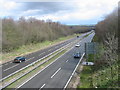


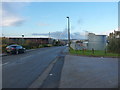

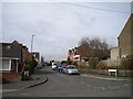
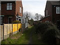
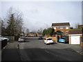

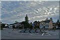
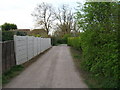
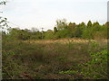
17 photos from this area
Area Information
Key information about the DE55 2AY including its size, population, and administrative classification.
- Area Type
- Postcode
- Area Size
- 1.3 hectares
- Population
- 1822
- Population Density
- 4325 people/km²
House Prices in DE55 2AY
34
Properties
£101,033
Average Sold Price
£20,000
Lowest Price
£165,000
Highest Price
Showing 34 properties
| Address | Type | Beds | Baths | Last Sale Price | Last Sale Date | |
|---|---|---|---|---|---|---|
| 73 George Street, South Normanton, DE55 2AY | Semi-detached | 2 | 2 | £140,000 | May 2025 | |
| 48 George Street, South Normanton, DE55 2AY | house | - | - | £135,000 | Oct 2024 | |
| 45 George Street, South Normanton, DE55 2AY | Semi-detached | 3 | 1 | £155,000 | Nov 2023 | |
| 40 George Street, South Normanton, DE55 2AY | Semi-detached | 3 | - | £92,000 | Jul 2023 | |
| 69 George Street, South Normanton, DE55 2AY | Semi-detached | 3 | 1 | £165,000 | Dec 2022 | |
| 65 George Street, South Normanton, DE55 2AY | house | 2 | 1 | £107,000 | May 2022 | |
| 54 George Street, South Normanton, DE55 2AY | Retail | 3 | 1 | £111,000 | Mar 2022 | |
| 55 George Street, South Normanton, DE55 2AY | Semi-detached | 2 | - | £73,000 | Mar 2020 | |
| 56 George Street, South Normanton, DE55 2AY | Semi-detached | 2 | 1 | £110,000 | Nov 2019 | |
| 62 George Street, South Normanton, DE55 2AY | Semi-detached | 3 | 1 | £94,000 | Oct 2019 |
Page 1 of 4
Energy Efficiency in DE55 2AY
Amenities
Schools
| Rank | School | Type | Entry gender | Ages |
|---|
Explore more schools in this area
Go to Schools tabDemographics
Household Size
Two person
most common
Accommodation Type
Houses
most common
Tenure
65
majority
Ethnic Group
White
most common
Religion
N/A
most common
Household Composition
N/A
most common
Age
47
median
Adults (30-64 years)
most common
Household Deprivation
N/A
with no deprivation
NS-SEC
25
in Lower managerial occupations
Explore more demographic insights in this area
Go to Demographics tabPlanning
Planning Constraints
- Flood RiskPremium
- Ramsar Wetland SitesPremium
- Area of Outstanding Natural BeautyPremium
- Protected Nature ReservePremium
- Protected WoodlandPremium