Area Overview for DE55 1NH
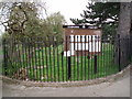
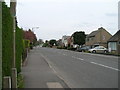
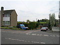
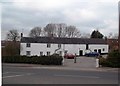
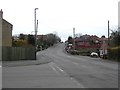
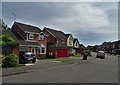
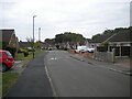
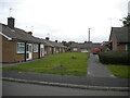
Photos of DE55 1NH
Area Information
Living in DE55 1NH offers a quiet, residential experience within a small cluster of homes. With a population of 1,180, the area is compact but well-served by essential services. The community is predominantly composed of adults aged 30–64, reflecting a stable, mature demographic. Most residents own their homes, with 84% of properties occupied by owners, suggesting a sense of permanence. The area is characterised by houses rather than flats, creating a distinct suburban feel. Daily life here is shaped by proximity to local amenities and transport links. The low crime risk and absence of environmental constraints like protected woodlands or wetlands contribute to a practical, low-maintenance lifestyle. While the area is small, its strategic placement near rail stations and retail hubs ensures connectivity to nearby towns. For buyers seeking a peaceful, family-friendly environment with reliable infrastructure, DE55 1NH provides a straightforward, no-frills option.
- Area Type
- Postcode
- Area Size
- Not available
- Population
- 1180
- Population Density
- 4040 people/km²
The property market in DE55 1NH is dominated by owner-occupied homes, with 84% of properties owned outright. This high home ownership rate suggests a community of long-term residents rather than a transient rental market. The area is composed almost entirely of houses, which contrasts with regions where flats or apartments predominate. This housing stock likely appeals to families or individuals seeking space and privacy. Given the small size of the postcode, the market is limited in scope, but the focus on owner-occupation indicates strong local demand. Buyers should consider the area’s compact nature, which means properties are likely to be in close proximity to one another. The absence of planning constraints or environmental restrictions adds to the practicality of purchasing here, though the limited number of properties may mean competition for available homes.
House Prices in DE55 1NH
No properties found in this postcode.
Energy Efficiency in DE55 1NH
The lifestyle in DE55 1NH is shaped by its proximity to essential amenities. Nearby retail options include Co-op Leabrooks, Iceland Alfreton, and Heron Greenhill, offering everyday shopping needs within reach. These stores cater to both household essentials and convenience purchases, reducing the need for long trips. The area’s rail stations—Alfreton, Ambergate, and Langley Mill—provide access to broader networks, enabling residents to reach cultural, professional, or recreational hubs in nearby towns. While the area itself is small, the practical reach of its amenities fosters a self-contained lifestyle. The absence of large parks or leisure facilities means outdoor activities may require travel, but the compact nature of the postcode ensures that daily errands and social interactions remain localised. This balance of convenience and limited sprawl suits those prioritising accessibility over expansive recreational spaces.
Amenities
Schools
| Rank | School | Type | Entry gender | Ages |
|---|
Explore more schools in this area
Go to Schools tabDemographics
The demographic profile of DE55 1NH is defined by its median age of 47, with the majority of residents falling within the 30–64 age range. This suggests a community of working-age adults and older families, rather than a younger or elderly population. Home ownership is high, at 84%, indicating a stable housing market with long-term residents. The area is predominantly composed of houses, which aligns with the demographic’s preference for family homes. The predominant ethnic group is White, though no data is provided on the presence of other groups. The absence of detailed diversity metrics means the community’s cultural composition remains unquantified. The low deprivation levels implied by the high home ownership and mature age profile suggest a quality of life focused on stability and self-sufficiency. This makes DE55 1NH appealing to those prioritising security over dynamic urban amenities.
Household Size
Accommodation Type
Tenure
Ethnic Group
Religion
Household Composition
Age
Household Deprivation
NS-SEC
Explore more demographic insights in this area
Go to Demographics tabPlanning
Planning Constraints
- Flood RiskPremium
- Ramsar Wetland SitesPremium
- Area of Outstanding Natural BeautyPremium
- Protected Nature ReservePremium
- Protected WoodlandPremium