Area Overview for DE5 9RH
Photos of DE5 9RH


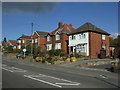


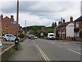
31 photos from this area
Area Information
Key information about the DE5 9RH including its size, population, and administrative classification.
- Area Type
- Postcode
- Area Size
- 11.8 hectares
- Population
- 1373
- Population Density
- 516 people/km²
House Prices in DE5 9RH
71
Properties
£188,297
Average Sold Price
£20,000
Lowest Price
£387,000
Highest Price
Showing 71 properties
| Address | Type | Beds | Baths | Last Sale Price | Last Sale Date | |
|---|---|---|---|---|---|---|
| 27-29 Nottingham Road, Codnor, Ripley, DE5 9RH | Terraced | 4 | 2 | £265,000 | Dec 2024 | |
| 59 Nottingham Road, Codnor, Ripley, DE5 9RH | Semi-detached | 2 | 1 | £189,950 | Jul 2024 | |
| 25 Nottingham Road, Codnor, Ripley, DE5 9RH | Terraced | 2 | 1 | £120,000 | Apr 2024 | |
| 44 Nottingham Road, Codnor, Ripley, DE5 9RH | Bungalow | 3 | 1 | £275,000 | Jan 2024 | |
| 20 Nottingham Road, Codnor, Ripley, DE5 9RH | Bungalow | - | - | £216,000 | Jan 2022 | |
| 67 Nottingham Road, Codnor, Ripley, DE5 9RH | Retail | 2 | 1 | £135,000 | Dec 2021 | |
| The Willows, 43A Nottingham Road, Codnor, Ripley, DE5 9RH | Bungalow | - | - | £339,000 | Aug 2021 | |
| Oaklands, 45 Nottingham Road, Codnor, Ripley, DE5 9RH | Bungalow | - | - | £335,000 | Jun 2021 | |
| 18 Nottingham Road, Codnor, Ripley, DE5 9RH | Bungalow | - | - | £225,000 | Jun 2021 | |
| 46 Nottingham Road, Codnor, Ripley, DE5 9RH | Bungalow | 3 | 2 | £327,500 | Mar 2021 |
Page 1 of 8
Energy Efficiency in DE5 9RH
Amenities
Schools
| Rank | School | Type | Entry gender | Ages |
|---|
Explore more schools in this area
Go to Schools tabDemographics
Household Size
One person
most common
Accommodation Type
Houses
most common
Tenure
67
majority
Ethnic Group
White
most common
Religion
N/A
most common
Household Composition
N/A
most common
Age
47
median
Adults (30-64 years)
most common
Household Deprivation
N/A
with no deprivation
NS-SEC
25
in Lower managerial occupations
Explore more demographic insights in this area
Go to Demographics tabPlanning
Planning Constraints
- Flood RiskPremium
- Ramsar Wetland SitesPremium
- Area of Outstanding Natural BeautyPremium
- Protected Nature ReservePremium
- Protected WoodlandPremium