Area Overview for DE5 8JG
Photos of DE5 8JG

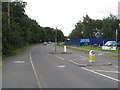
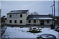
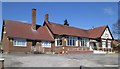
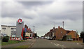
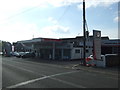
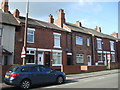
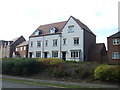
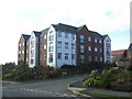
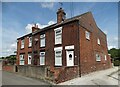
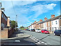
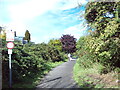
28 photos from this area
Area Information
Key information about the DE5 8JG including its size, population, and administrative classification.
- Area Type
- Postcode
- Area Size
- 26.0 hectares
- Population
- 1518
- Population Density
- 1430 people/km²
House Prices in DE5 8JG
13
Properties
£130,250
Average Sold Price
£35,500
Lowest Price
£295,000
Highest Price
Showing 13 properties
| Address | Type | Beds | Baths | Last Sale Price | Last Sale Date | |
|---|---|---|---|---|---|---|
| 145 Upper Marehay Road, Marehay, Ripley, DE5 8JG | Semi-detached | 3 | 2 | £295,000 | Mar 2025 | |
| 95 Upper Marehay Road, Marehay, Ripley, DE5 8JG | house | - | - | £187,000 | Jul 2024 | |
| 99 Upper Marehay Road, Marehay, Ripley, DE5 8JG | Semi-detached | 3 | - | £132,000 | Oct 2014 | |
| 58 Upper Marehay Road, Marehay, Ripley, DE5 8JG | Detached | - | - | £128,000 | Aug 2008 | |
| 60 Upper Marehay Road, Marehay, Ripley, DE5 8JG | Terraced | - | - | £70,000 | Sep 2004 | |
| 101 Upper Marehay Road, Marehay, Ripley, DE5 8JG | house | - | - | £64,250 | Dec 2001 | |
| 93 Upper Marehay Road, Marehay, Ripley, DE5 8JG | Semi-detached | - | - | £35,500 | Feb 2000 | |
| Ta Equipilates, Equipilates, 56 Upper Marehay Road, Marehay, Ripley, DE5 8JG | Retail | - | - | - | - | |
| 56 Upper Marehay Road, Marehay, Ripley, DE5 8JG | Detached | - | - | - | - | |
| 62 Upper Marehay Road, Marehay, Ripley, DE5 8JG | Terraced | - | - | - | - |
Page 1 of 2
Energy Efficiency in DE5 8JG
Amenities
Schools
| Rank | School | Type | Entry gender | Ages |
|---|
Explore more schools in this area
Go to Schools tabDemographics
Household Size
Two person
most common
Accommodation Type
Houses
most common
Tenure
79
majority
Ethnic Group
White
most common
Religion
N/A
most common
Household Composition
N/A
most common
Age
47
median
Adults (30-64 years)
most common
Household Deprivation
N/A
with no deprivation
NS-SEC
32
in Lower managerial occupations
Explore more demographic insights in this area
Go to Demographics tabPlanning
Planning Constraints
- Flood RiskPremium
- Ramsar Wetland SitesPremium
- Area of Outstanding Natural BeautyPremium
- Protected Nature ReservePremium
- Protected WoodlandPremium