Area Overview for DE5 7SA
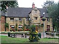
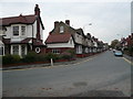
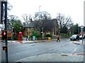
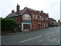
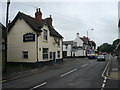
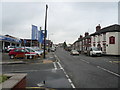
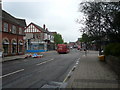
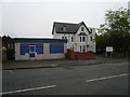
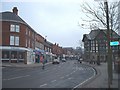
Photos of DE5 7SA


Area Information
Living in DE5 7SA means inhabiting a compact, residential cluster in England with a population of 1712 people spread over a dense 860 people per square kilometre. This small area is characterised by its proximity to local amenities and a mix of housing stock. The community is predominantly made up of adults aged 30–64, suggesting a mature demographic with established roots. Daily life here is shaped by the availability of nearby schools, retail outlets, and rail connections, making it practical for families and commuters. While the area lacks large-scale infrastructure, its size ensures a tight-knit feel, with residents likely to know their neighbours. The presence of multiple primary schools and a Catholic academy indicates a focus on education, while the rail network provides access to broader regional hubs. For those seeking a balanced blend of convenience and quiet living, DE5 7SA offers a snapshot of suburban England, where practicality meets community cohesion.
- Area Type
- Postcode
- Area Size
- Not available
- Population
- 1712
- Population Density
- 860 people/km²
The property market in DE5 7SA is dominated by houses, with 48% of properties owned by residents and the remainder likely rented. This suggests a balance between owner-occupied homes and rental stock, though the exact proportion of rentals is not specified. Given the area’s small size and residential focus, housing stock is limited, which may make the market competitive for buyers. The prevalence of houses over flats or apartments indicates a preference for traditional, family-friendly properties. For buyers, this means a focus on individual homes rather than high-density developments. However, the lack of detailed data on property prices or availability means potential buyers should consider the broader regional market for context. The compact nature of DE5 7SA also means that properties are likely to be in close proximity to local amenities, which could be a key selling point for those prioritising convenience.
House Prices in DE5 7SA
No properties found in this postcode.
Energy Efficiency in DE5 7SA
Residents of DE5 7SA benefit from a selection of nearby amenities, including retail outlets and rail stations. The area’s retail offerings include Tesco Alfreton, Farmfoods Alfreton, and Lidl Alfreton, providing essential shopping options within practical reach. These stores cater to daily needs, from groceries to household items, reducing the need for long commutes. The rail network, with stations at Alfreton, Ambergate, and Whatstandwell, enhances connectivity, making it easier to access broader services or social opportunities beyond the immediate area. While the data does not specify parks or leisure facilities, the presence of multiple schools and retail hubs suggests a focus on practicality over expansive recreational spaces. This lifestyle reflects a community prioritising accessibility and convenience, with amenities tailored to meet the needs of a mature, residential population.
Amenities
Schools
Residents of DE5 7SA have access to a range of educational institutions, including primary schools and a Catholic academy. Croft Infant School and Copthorne Community Infant School both hold Ofsted ratings of ‘good’, indicating strong performance in early education. Christ The King Catholic Primary and Christ the King Catholic Voluntary Academy further diversify the school options, with the latter operating as an academy. The presence of Alfreton Park Community Special School adds specialist provision for students with specific needs. This mix of school types ensures families can choose between mainstream education, faith-based institutions, and specialist support. The concentration of schools in the area suggests a focus on education, which may appeal to families prioritising proximity to learning institutions. With multiple options within walking distance, DE5 7SA offers flexibility for parents navigating school admissions.
| Rank | School | Type | Entry gender | Ages |
|---|
Explore more schools in this area
Go to Schools tabDemographics
The community in DE5 7SA is defined by its median age of 47, with the majority of residents falling within the 30–64 age range. This suggests a population of working-age adults and older homeowners, which may influence local services and amenities. Home ownership rates here are 48%, meaning nearly half of properties are rented, indicating a mix of owner-occupied and rental housing. The predominant accommodation type is houses, which aligns with the area’s residential character. The predominant ethnic group is White, reflecting broader national trends in this region. With a population density of 860 people per square kilometre, the area is neither sprawling nor sparse, creating a compact living environment. This density, combined with the age profile, may mean a community that prioritises stability over rapid growth, with local services tailored to a mature demographic.
Household Size
Accommodation Type
Tenure
Ethnic Group
Religion
Household Composition
Age
Household Deprivation
NS-SEC
Explore more demographic insights in this area
Go to Demographics tabPlanning
Planning Constraints
- Flood RiskPremium
- Ramsar Wetland SitesPremium
- Area of Outstanding Natural BeautyPremium
- Protected Nature ReservePremium
- Protected WoodlandPremium