Area Overview for DE5 7PE
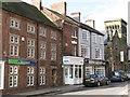
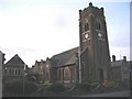
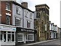
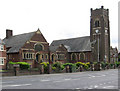
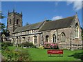
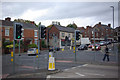
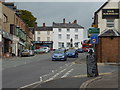
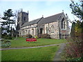
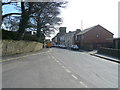
Photos of DE5 7PE


Area Information
Living in DE5 7PE offers a quiet, residential experience in a small cluster of homes with a population of 1984. The area is defined by its modest scale and proximity to essential services, making it suitable for those seeking a balanced lifestyle. With a median age of 47, the community is predominantly composed of adults aged 30–64, suggesting a stable, mature demographic. Daily life here is shaped by local amenities and straightforward connectivity. The area’s compact size means residents are close to schools, shops, and rail links, though its small footprint also means it is best suited for those prioritising convenience over sprawling landscapes. DE5 7PE is not a high-density zone, with homes outnumbering flats, and the majority of properties are owner-occupied. This reflects a community rooted in long-term residency rather than transient tenancy. While the area lacks dramatic natural features, its practicality and accessibility make it a viable choice for buyers seeking a manageable, low-maintenance environment.
- Area Type
- Postcode
- Area Size
- Not available
- Population
- 1984
- Population Density
- 2208 people/km²
The property market in DE5 7PE is characterised by a high proportion of owner-occupied homes, with 69% of properties owned by residents rather than rented. This suggests a community with long-term residency and a focus on stability over investment. The accommodation type is predominantly houses, which is typical for smaller, rural or semi-rural postcodes. This contrasts with areas dominated by flats or apartments, where rental demand often drives market dynamics. For buyers, this means the housing stock is limited in scale, with fewer opportunities for high-density development. The small size of the area also means that property availability is constrained, requiring buyers to consider nearby postcodes for more options. The owner-occupation rate indicates that the market is less influenced by short-term rental trends, which could be a positive for those seeking a permanent home in a low-turnover environment.
House Prices in DE5 7PE
No properties found in this postcode.
Energy Efficiency in DE5 7PE
The lifestyle in DE5 7PE is shaped by its proximity to practical amenities. Nearby retail options include Tesco Alfreton, Farmfoods Alfreton, and Lidl Alfreton, providing essential shopping and food services within walking or short driving distance. The area’s rail stations—Alfreton, Ambergate, and Whatstandwell—offer access to broader regional networks, facilitating travel for work, leisure, or social purposes. While the area lacks large parks or leisure facilities, its compact nature ensures that daily needs are met without long commutes. The presence of multiple schools and shops contributes to a self-contained community feel, where residents can manage routine tasks locally. This blend of convenience and accessibility supports a low-maintenance lifestyle, ideal for those prioritising practicality over expansive recreational spaces.
Amenities
Schools
DE5 7PE is served by a range of educational institutions, including Alfreton Nursery School, which provides early years education, and Woodbridge Junior School, rated ‘good’ by Ofsted. Alfreton Grange Arts College and David Nieper Academy, both rated ‘good’, offer primary education, while Watchorn Christian School, an independent institution also rated ‘good’, provides alternative schooling options. The mix of state and independent schools gives families flexibility in choosing between free public education and fee-paying alternatives. This diversity ensures that parents can select a school that aligns with their priorities, whether they prefer a traditional state school, a specialist academy, or an independent setting. The presence of multiple schools within practical reach of the area reinforces its appeal for families seeking a range of educational choices without long commutes.
| Rank | School | Type | Entry gender | Ages |
|---|
Explore more schools in this area
Go to Schools tabDemographics
The community in DE5 7PE is predominantly composed of adults aged 30–64, with a median age of 47. This suggests a mature population, likely with established careers and families. Home ownership stands at 69%, indicating a strong presence of long-term residents rather than renters. The accommodation type is primarily houses, which aligns with the area’s small, residential character. The predominant ethnic group is White, reflecting a homogenous demographic profile. While this data does not provide direct insight into deprivation levels, the combination of home ownership and age distribution implies a community with relatively stable economic conditions. The absence of significant diversity data means the area’s social fabric is likely shaped by shared cultural and generational experiences. For buyers, this suggests a neighbourhood with a consistent, low-turnover population, which can be advantageous for those seeking stability and familiarity in their surroundings.
Household Size
Accommodation Type
Tenure
Ethnic Group
Religion
Household Composition
Age
Household Deprivation
NS-SEC
Explore more demographic insights in this area
Go to Demographics tabPlanning
Planning Constraints
- Flood RiskPremium
- Ramsar Wetland SitesPremium
- Area of Outstanding Natural BeautyPremium
- Protected Nature ReservePremium
- Protected WoodlandPremium