Area Overview for DE5 7EG
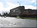
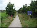
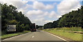
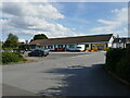
Photos of DE5 7EG

Area Information
Living in DE5 7EG means being part of a tightly knit residential cluster in central England, where the population of 1,398 residents occupies a compact area at a density of 886 people per square kilometre. This postcode is characterised by its small-scale, community-focused environment, with homes primarily in the form of houses rather than flats. The area’s proximity to rail networks and local amenities makes it accessible for commuters, while its modest size fosters a sense of familiarity. Daily life here is shaped by nearby schools, retail options, and rail links, creating a balance between suburban comfort and practical connectivity. The median age of 47 suggests a mature demographic, with many residents in their 30s to 60s, contributing to a stable, established community. For those seeking a place where convenience meets a quieter lifestyle, DE5 7EG offers a blend of practicality and local charm, though its small footprint means the immediate surroundings are key to understanding its full appeal.
- Area Type
- Postcode
- Area Size
- Not available
- Population
- 1398
- Population Density
- 886 people/km²
The property market in DE5 7EG is defined by a 46% home ownership rate, which is lower than the national average, suggesting that a significant portion of the housing stock is rented out. The area’s accommodation type is predominantly houses, which contrasts with regions where flats or apartments dominate. This mix may appeal to buyers seeking traditional family homes, though the limited size of the postcode means the housing options are constrained. The small residential cluster implies that properties here are likely to be in close proximity to local amenities, such as schools and rail stations. For buyers, this could mean competition for a limited number of homes, particularly in the immediate vicinity. The focus on owner-occupied properties may also indicate that the area is not a major rental hotspot, though the 46% figure suggests a balance between private ownership and lettings.
House Prices in DE5 7EG
No properties found in this postcode.
Energy Efficiency in DE5 7EG
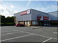
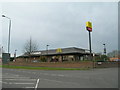
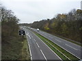
The lifestyle in DE5 7EG is shaped by its proximity to retail and rail hubs. Local shops such as Aldi Somercotes, Iceland Alfreton, and Co-op Alfreton provide essential shopping options, while nearby rail stations like Alfreton Railway Station offer connectivity to surrounding areas. This combination of retail and transport infrastructure ensures that daily errands and commuting are manageable without long journeys. The area’s compact nature means that amenities are concentrated, contributing to a sense of convenience. However, the lack of larger leisure or entertainment venues may require residents to venture further for activities beyond shopping and travel. The presence of schools and rail links, paired with accessible retail, creates a functional lifestyle that prioritises practicality over expansive leisure options.
Amenities
Schools
Residents of DE5 7EG have access to a range of schools, including primary schools and academies. Somerlea Park Junior School and Somercotes Infant School cater to younger children, while Somercotes Infant and Nursery School, rated ‘good’ by Ofsted, offers early years education. The presence of two academies, both with a ‘good’ rating, adds variety to the educational options. This mix of school types ensures that families have choices, whether they prefer traditional state schools or academy-led institutions. The proximity of these schools to the area underscores its appeal for families seeking a stable education system. However, the absence of secondary schools in the immediate vicinity may require students to commute further afield, which is a practical consideration for parents evaluating the area.
| Rank | School | Type | Entry gender | Ages |
|---|
Explore more schools in this area
Go to Schools tabDemographics
The community in DE5 7EG is predominantly composed of adults aged 30 to 64, with a median age of 47. This suggests a population that is largely settled, with fewer young families or retirees compared to other areas. Home ownership stands at 46%, indicating that nearly half of residents rent their homes, which may reflect the area’s smaller housing stock and limited availability of owner-occupied properties. The predominant ethnic group is White, with no specific data on other demographics provided. The high population density of 886 people per square kilometre, combined with the focus on house-based accommodation, implies a mix of family homes and smaller properties. While the data does not specify deprivation levels, the demographic profile points to a community that is relatively stable but may lack the diversity or younger population typical of larger urban centres.
Household Size
Accommodation Type
Tenure
Ethnic Group
Religion
Household Composition
Age
Household Deprivation
NS-SEC
Explore more demographic insights in this area
Go to Demographics tabPlanning
Planning Constraints
- Flood RiskPremium
- Ramsar Wetland SitesPremium
- Area of Outstanding Natural BeautyPremium
- Protected Nature ReservePremium
- Protected WoodlandPremium