Area Overview for DE5 3YD
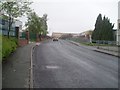
Photos of DE5 3YD


Area Information
Living in DE5 3YD means being part of a compact, residential cluster in England’s countryside, where 1,854 people live across a densely populated area of 725 people per square kilometre. This postcode is defined by its small scale and proximity to essential services, making it practical for daily life. The community is predominantly composed of adults aged 30–64, with a median age of 47, suggesting a stable, family-oriented environment. While the area lacks large urban amenities, its proximity to rail stations and local shops ensures convenience. The low flood risk and absence of environmental constraints like protected woodlands or AONB designations mean residents face minimal planning restrictions. However, the high crime risk—rated critical with a safety score of 1/100—demands attention. For those prioritising security, this postcode may require careful consideration, despite its otherwise functional layout and access to nearby primary schools and retail hubs.
- Area Type
- Postcode
- Area Size
- Not available
- Population
- 1854
- Population Density
- 725 people/km²
The property market in DE5 3YD is characterised by a high rate of home ownership—70% of residents own their homes—suggesting a community rooted in long-term residency. The accommodation type is predominantly houses, which is unusual in smaller postcode areas and may reflect a preference for family-friendly, spacious living. This makes the area less likely to be a rental hotspot, with properties more suited to owner-occupiers seeking stability. However, the small size of the postcode means the housing stock is limited, and buyers should consider the immediate surroundings for more options. The absence of flats or apartments further reinforces the area’s appeal to those prioritising private, detached living.
House Prices in DE5 3YD
Showing 2 properties
| Address | Type | Beds | Baths | Last Sale Price | Last Sale Date | |
|---|---|---|---|---|---|---|
| Tudor Models Ltd, The Dolls House Emporium, High Holborn Road, Codnor Gate, Ripley, DE5 3YD | retail_financial | - | - | - | - | |
| Tudor Models Ltd, Avbc Unit 26, High Holborn Road, Codnor Gate, Ripley, DE5 3YD | Industrial | - | - | - | - |
Energy Efficiency in DE5 3YD
Daily life in DE5 3YD is supported by nearby amenities, including five retail outlets such as Tesco Codnor, Sainsburys Ripley, and Farmfoods Marehay, offering shopping and grocery needs. The rail stations—Langley Mill, Alfreton, and Ambergate—provide easy access to broader regional networks, enhancing mobility. While the area lacks large parks or leisure facilities, the proximity to these services ensures practical convenience. The small scale of the postcode means amenities are closely clustered, reducing travel time for essentials. This compact layout fosters a self-contained lifestyle, ideal for those prioritising accessibility over expansive recreational spaces.
Amenities
Schools
The nearest school to DE5 3YD is Ripley St John’s Church of England Primary School and Nursery, rated ‘good’ by Ofsted. This primary school serves the local community, offering education for younger children. The absence of secondary schools in the immediate area means families may need to look beyond DE5 3YD for secondary education, though nearby towns likely provide options. The presence of a well-rated primary school is a key draw for families, ensuring children have access to quality early education. However, the limited range of school types highlights the need for broader regional planning for older students.
| Rank | School | Type | Entry gender | Ages |
|---|
Explore more schools in this area
Go to Schools tabDemographics
DE5 3YD’s population skews heavily towards adults aged 30–64, with a median age of 47. This suggests a mature, established community, likely centred on family life and long-term residency. Home ownership is high at 70%, with houses being the predominant accommodation type, indicating a focus on private, stable living rather than rental properties. The area’s demographic profile is largely homogenous, with the White ethnic group making up the majority. While no specific data on deprivation is provided, the high home ownership rate and age distribution imply a relatively stable economic environment. However, the absence of detailed diversity metrics means the full range of community experiences remains unexplored.
Household Size
Accommodation Type
Tenure
Ethnic Group
Religion
Household Composition
Age
Household Deprivation
NS-SEC
Explore more demographic insights in this area
Go to Demographics tabPlanning
Planning Constraints
- Flood RiskPremium
- Ramsar Wetland SitesPremium
- Area of Outstanding Natural BeautyPremium
- Protected Nature ReservePremium
- Protected WoodlandPremium