Area Overview for DE5 1JQ
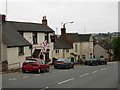
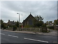
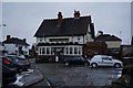
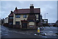
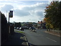
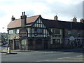
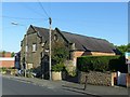
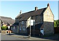
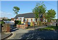
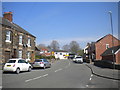
Photos of DE5 1JQ


Area Information
Living in DE5 1JQ offers a quiet, residential experience within a small cluster of homes. With a population of 1,682, the area feels close-knit, where daily life is shaped by proximity to local amenities and a stable community. The median age of 47 suggests a mix of established residents and families, with the majority of households being adults aged 30–64. This demographic profile indicates a mature, settled environment, where home ownership is high at 85%, reflecting long-term residency. The area is predominantly composed of houses, which contributes to a more private, family-oriented atmosphere. Nearby, schools such as Pottery Primary School and St John’s CofE Primary School provide essential education for local children, while rail stations like Belper and Ambergate offer connectivity to wider regions. DE5 1JQ balances rural tranquillity with practical access to services, making it appealing for those seeking a stable, low-maintenance lifestyle.
- Area Type
- Postcode
- Area Size
- Not available
- Population
- 1682
- Population Density
- 4866 people/km²
The property market in DE5 1JQ is dominated by owner-occupied homes, with 85% of properties owned by residents rather than rented. This high rate of home ownership points to a community of long-term residents who have invested in their homes, creating a stable and cohesive neighbourhood. The accommodation type is primarily houses, which are typically larger and more private than flats, catering to families and those prioritising space. Given the small size of the area, the housing stock is limited, meaning properties are likely to be in demand. Buyers should consider the scarcity of options, as the cluster of homes may not accommodate rapid growth. For those seeking a home in DE5 1JQ, the focus is on established, family-friendly properties with long-term value.
House Prices in DE5 1JQ
No properties found in this postcode.
Energy Efficiency in DE5 1JQ
Residents of DE5 1JQ benefit from a range of nearby amenities that support daily life. The area’s retail options include Co-op Whitemoor, Tesco Alton, and Co-op Openwood, providing essential shopping and grocery needs within reach. Rail stations such as Belper and Ambergate offer access to public transport, while metro stations at Idridgehay and Wirksworth cater to longer-distance travel. Though the data does not mention parks or leisure facilities explicitly, the proximity to rail networks and retail hubs suggests a lifestyle that balances convenience with the possibility of exploring nearby towns. The presence of multiple schools and transport links enhances the area’s appeal, ensuring residents can access education, shopping, and connectivity without significant travel. This mix of amenities supports a practical, community-focused lifestyle.
Amenities
Schools
Residents of DE5 1JQ have access to two primary schools: Pottery Primary School, which holds an Ofsted rating of satisfactory, and St John’s CofE Primary School and Nursery, rated good by Ofsted. Both institutions cater to young children, providing essential early education. The presence of two primary schools offers families choice, with St John’s CofE likely offering a faith-based curriculum alongside its good rating. Pottery Primary, while rated satisfactory, still meets acceptable standards for education. The proximity of these schools to homes in DE5 1JQ ensures that parents can easily access local education for their children. The mix of school types reflects a range of educational approaches, though no secondary schools are listed in the data, which may require families to travel further for older children’s schooling.
| Rank | School | Type | Entry gender | Ages |
|---|
Explore more schools in this area
Go to Schools tabDemographics
The community in DE5 1JQ is characterised by a median age of 47, with the most common age range being adults aged 30–64. This suggests a population that is largely middle-aged, with a focus on family life and long-term residency. Home ownership is exceptionally high at 85%, indicating a strong sense of stability and investment in the area. The predominant accommodation type is houses, which aligns with the demographic’s preference for private, family-oriented living. The predominant ethnic group is White, reflecting a homogenous community. While no specific deprivation data is provided, the high home ownership rate and low crime risk suggest a generally secure and economically stable environment. The absence of significant diversity data does not detract from the area’s appeal for those seeking a traditional, settled lifestyle.
Household Size
Accommodation Type
Tenure
Ethnic Group
Religion
Household Composition
Age
Household Deprivation
NS-SEC
Explore more demographic insights in this area
Go to Demographics tabPlanning
Planning Constraints
- Flood RiskPremium
- Ramsar Wetland SitesPremium
- Area of Outstanding Natural BeautyPremium
- Protected Nature ReservePremium
- Protected WoodlandPremium