Area Overview for DE5 1AH
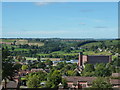
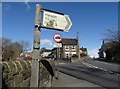
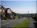
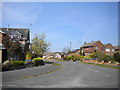
Photos of DE5 1AH


Area Information
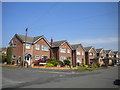
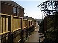
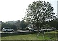
Living in DE5 1AH means being part of a tightly knit residential cluster in England, where 1,388 people reside across a compact area. With a population density of 1,121 people per square kilometre, this postcode reflects a mature, established community. The area’s character is defined by its focus on housing, with 86% of residents owning their homes. Daily life here is shaped by proximity to key amenities, including five retail outlets like Tesco Alton and Co-op Whitemoor, and five railway stations such as Belper and Ambergate, offering easy access to regional travel. The median age of 47 suggests a predominantly adult population, with many residents aged 30–64, creating a stable, family-oriented environment. While the area lacks natural constraints like protected woodlands or wetlands, its safety profile is strong, with a crime risk score of 96. This small postcode is ideal for those seeking a balanced blend of practicality, safety, and connectivity, with homes primarily in traditional styles that reflect the region’s heritage.
- Area Type
- Postcode
- Area Size
- Not available
- Population
- 1388
- Population Density
- 1121 people/km²
The property market in DE5 1AH is characterised by a high rate of home ownership (86%) and a focus on housing rather than flats or other property types. This suggests a community where most residents are long-term owners, with limited rental activity. The area’s small size means the housing stock is finite, but the proximity to nearby towns like Wirksworth and Idridgehay offers additional options for buyers seeking more space or different styles. The predominance of houses over other property types indicates a preference for traditional, family-friendly homes. For buyers, this means a market that prioritises stability and permanence, though the limited size of DE5 1AH itself may require looking beyond the immediate postcode for larger or newer properties.
House Prices in DE5 1AH
No properties found in this postcode.
Energy Efficiency in DE5 1AH
Daily life in DE5 1AH is enriched by nearby amenities that cater to practical needs and convenience. The area’s retail options include established stores like Tesco Alton, Co-op Whitemoor, and Co-op Belper, ensuring residents have access to essential shopping without long journeys. The railway network, with stations such as Belper and Ambergate, facilitates easy travel to larger towns and cities, while metro links to Idridgehay and Wirksworth provide additional mobility. Though the postcode itself is small, its proximity to these amenities means residents can enjoy a mix of local services and regional connectivity. The character of the area is defined by its practicality, with shops, transport, and community hubs all within reach, supporting a lifestyle that balances routine with accessibility.
Amenities
Schools
| Rank | School | Type | Entry gender | Ages |
|---|
Explore more schools in this area
Go to Schools tabDemographics
DE5 1AH is home to a population with a median age of 47, indicating a mature demographic where most residents fall within the 30–64 age range. Home ownership is exceptionally high at 86%, suggesting a stable, long-term community with minimal rental activity. The area is predominantly composed of houses, which aligns with the higher proportion of owner-occupied properties. The predominant ethnic group is White, reflecting the region’s demographic profile. With no data on deprivation levels, the focus remains on the tangible aspects of life here: a high proportion of adults, a strong sense of local identity, and a housing stock that caters to established families and professionals. The absence of younger demographics or transient populations underscores a community that values continuity and security.
Household Size
Accommodation Type
Tenure
Ethnic Group
Religion
Household Composition
Age
Household Deprivation
NS-SEC
Explore more demographic insights in this area
Go to Demographics tabPlanning
Planning Constraints
- Flood RiskPremium
- Ramsar Wetland SitesPremium
- Area of Outstanding Natural BeautyPremium
- Protected Nature ReservePremium
- Protected WoodlandPremium