Area Overview for DE45 1QN
Photos of DE45 1QN
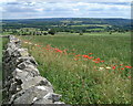
![Three ways to go [1] in DE45 1QN](https://images.propbar.co.uk/images/geograph/58/50/5850200_120.jpg)
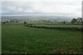
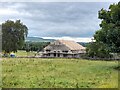
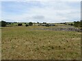
63 photos from this area
Area Information
Key information about the DE45 1QN including its size, population, and administrative classification.
- Area Type
- Postcode
- Area Size
- 73.0 hectares
- Population
- 1378
- Population Density
- 68 people/km²
House Prices in DE45 1QN
40
Properties
£860,000
Average Sold Price
£250,000
Lowest Price
£1,350,000
Highest Price
Showing 40 properties
| Address | Type | Beds | Baths | Last Sale Price | Last Sale Date | |
|---|---|---|---|---|---|---|
| Early Bank, Vicarage Lane, Ashford In The Water, DE45 1QN | house | 3 | 2 | £980,000 | Apr 2025 | |
| The Old Vicarage, Vicarage Lane, Ashford In The Water, DE45 1QN | Detached | - | - | £1,350,000 | Jul 2020 | |
| Ploverfield, Pennyunk Lane, Ashford In The Water, DE45 1QN | Bungalow | - | - | £250,000 | Dec 2012 | |
| School House, Vicarage Lane, Ashford In The Water, DE45 1QN | Semi-detached | 4 | 1 | - | - | |
| Chy An Dour, Vicarage Lane, Ashford In The Water, DE45 1QN | house | 4 | 4 | - | - | |
| 6 Highfield, Ashford In The Water, DE45 1QN | Semi-detached | 4 | 2 | - | - | |
| 21 Highfield, Ashford In The Water, DE45 1QN | Terraced | 3 | 1 | - | - | |
| 23 Highfield, Ashford In The Water, DE45 1QN | house | 3 | - | - | - | |
| 24 Highfield, Ashford In The Water, DE45 1QN | Terraced | 3 | - | - | - | |
| Annexe, The Old Vicarage, Vicarage Lane, Ashford In The Water, DE45 1QN | Semi-detached | - | - | - | - |
Page 1 of 4
Energy Efficiency in DE45 1QN
Amenities
Schools
| Rank | School | Type | Entry gender | Ages |
|---|
Explore more schools in this area
Go to Schools tabDemographics
Household Size
One person
most common
Accommodation Type
Houses
most common
Tenure
70
majority
Ethnic Group
White
most common
Religion
N/A
most common
Household Composition
N/A
most common
Age
47
median
Adults (30-64 years)
most common
Household Deprivation
N/A
with no deprivation
NS-SEC
43
in Lower managerial occupations
Explore more demographic insights in this area
Go to Demographics tabPlanning
Planning Constraints
- Flood RiskPremium
- Ramsar Wetland SitesPremium
- Area of Outstanding Natural BeautyPremium
- Protected Nature ReservePremium
- Protected WoodlandPremium