Area Overview for DE45 1JH
Photos of DE45 1JH
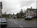
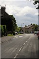
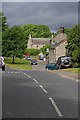
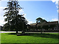
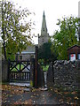
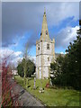
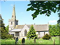
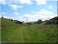
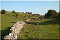
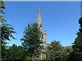
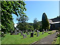
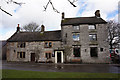
100 photos from this area
Area Information
Key information about the DE45 1JH including its size, population, and administrative classification.
- Area Type
- Postcode
- Area Size
- 93.0 hectares
- Population
- 1519
- Population Density
- 39 people/km²
House Prices in DE45 1JH
42
Properties
£361,868
Average Sold Price
£57,000
Lowest Price
£850,000
Highest Price
Showing 42 properties
| Address | Type | Beds | Baths | Last Sale Price | Last Sale Date | |
|---|---|---|---|---|---|---|
| The Croft, Church Street, Monyash, DE45 1JH | Detached | 4 | 2 | £658,000 | Oct 2025 | |
| 1, The Paddock, Church Street, Monyash, DE45 1JH | Cottage | 3 | 1 | £345,000 | Mar 2024 | |
| Lathkill House, Church Street, Monyash, DE45 1JH | Semi-detached | 3 | 3 | £565,000 | Mar 2024 | |
| Rose Cottage, 20 Church Street, Monyash, DE45 1JH | house | - | - | £300,000 | Jul 2023 | |
| Lathkill View, Church Street, Monyash, DE45 1JH | house | - | - | £435,000 | Feb 2023 | |
| Wensley Cottage, Church Street, Monyash, DE45 1JH | house | - | - | £300,000 | Sep 2022 | |
| 2 The Square, Monyash, DE45 1JH | house | 3 | 1 | £320,000 | Aug 2022 | |
| Church View Farm, Church Street, Monyash, DE45 1JH | house | - | - | £590,000 | Mar 2022 | |
| Lea House, Church Street, Monyash, DE45 1JH | Detached | 3 | 1 | £485,000 | Jan 2022 | |
| Ash Barn, Church Street, Monyash, DE45 1JH | house | 5 | - | £850,000 | Mar 2021 |
Page 1 of 5
Energy Efficiency in DE45 1JH
Amenities
Schools
| Rank | School | Type | Entry gender | Ages |
|---|
Explore more schools in this area
Go to Schools tabDemographics
Household Size
Two person
most common
Accommodation Type
Houses
most common
Tenure
69
majority
Ethnic Group
White
most common
Religion
N/A
most common
Household Composition
N/A
most common
Age
47
median
Adults (30-64 years)
most common
Household Deprivation
N/A
with no deprivation
NS-SEC
36
in Lower managerial occupations
Explore more demographic insights in this area
Go to Demographics tabPlanning
Planning Constraints
- Flood RiskPremium
- Ramsar Wetland SitesPremium
- Area of Outstanding Natural BeautyPremium
- Protected Nature ReservePremium
- Protected WoodlandPremium