Area Overview for DE45 1EB
Photos of DE45 1EB
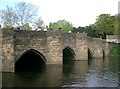
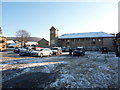


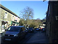
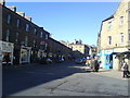
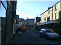
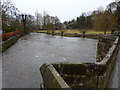


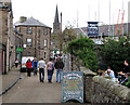
100 photos from this area
Area Information
Key information about the DE45 1EB including its size, population, and administrative classification.
- Area Type
- Postcode
- Area Size
- 2.2 hectares
- Population
- 1520
- Population Density
- 1427 people/km²
House Prices in DE45 1EB
28
Properties
£398,885
Average Sold Price
£170,000
Lowest Price
£888,000
Highest Price
Showing 28 properties
| Address | Type | Beds | Baths | Last Sale Price | Last Sale Date | |
|---|---|---|---|---|---|---|
| Mountville, Butts Road, Bakewell, DE45 1EB | Semi-detached | 3 | 2 | £485,000 | Mar 2025 | |
| Woodside Cottage, Butts Road, Bakewell, DE45 1EB | house | - | - | £360,000 | Nov 2024 | |
| The Spinney, Butts Road, Bakewell, DE45 1EB | house | 4 | 2 | £675,000 | Oct 2024 | |
| Holly Bank Cottage, Butts Road, Bakewell, DE45 1EB | house | - | - | £888,000 | Aug 2022 | |
| 6, Butts Terrace, Butts Road, Bakewell, DE45 1EB | Cottage | 2 | - | £380,000 | Jul 2022 | |
| Beech Cottage, Butts Road, Bakewell, DE45 1EB | house | 2 | - | £325,000 | Jun 2022 | |
| 1, Butts Terrace, Butts Road, Bakewell, DE45 1EB | Terraced | 2 | 1 | £265,000 | Aug 2017 | |
| Hooley House, 14 Butts Road, Bakewell, DE45 1EB | Detached | 3 | 2 | £300,000 | Mar 2016 | |
| Erica Cottage, Butts Road, Bakewell, DE45 1EB | Detached | 4 | - | £315,000 | Jan 2015 | |
| 4, Butts Terrace, Butts Road, Bakewell, DE45 1EB | Character Property | 4 | 4 | £212,500 | Nov 2014 |
Page 1 of 3
Energy Efficiency in DE45 1EB
Amenities
Schools
| Rank | School | Type | Entry gender | Ages |
|---|
Explore more schools in this area
Go to Schools tabDemographics
Household Size
One person
most common
Accommodation Type
Houses
most common
Tenure
61
majority
Ethnic Group
White
most common
Religion
N/A
most common
Household Composition
N/A
most common
Age
47
median
Adults (30-64 years)
most common
Household Deprivation
N/A
with no deprivation
NS-SEC
32
in Lower managerial occupations
Explore more demographic insights in this area
Go to Demographics tabPlanning
Planning Constraints
- Flood RiskPremium
- Ramsar Wetland SitesPremium
- Area of Outstanding Natural BeautyPremium
- Protected Nature ReservePremium
- Protected WoodlandPremium