Area Overview for DE4 5FY
Photos of DE4 5FY
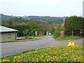

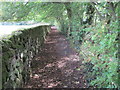
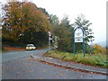
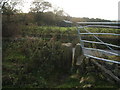
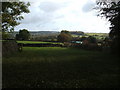
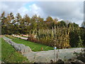
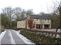
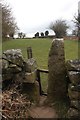
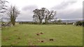
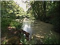
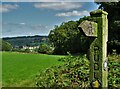
36 photos from this area
Area Information
Key information about the DE4 5FY including its size, population, and administrative classification.
- Area Type
- Postcode
- Area Size
- 51.6 hectares
- Population
- 1176
- Population Density
- 241 people/km²
House Prices in DE4 5FY
66
Properties
£343,375
Average Sold Price
£100,000
Lowest Price
£780,000
Highest Price
Showing 66 properties
| Address | Type | Beds | Baths | Last Sale Price | Last Sale Date | |
|---|---|---|---|---|---|---|
| High Bank, Alfreton Road, The Cliff, Tansley, DE4 5FY | Semi-detached | 2 | 1 | £211,000 | Mar 2025 | |
| Coach House, Old Coach Road, Tansley, DE4 5FY | Detached | 5 | 3 | £780,000 | Sep 2024 | |
| Vine Cottage, Alfreton Road, The Cliff, Tansley, DE4 5FY | Semi-detached | 3 | 1 | £225,000 | Apr 2024 | |
| The Retreat, Old Coach Road, Tansley, DE4 5FY | Bungalow | 5 | 2 | £595,000 | Jun 2023 | |
| The Bungalow, Old Coach Road, Tansley, DE4 5FY | Bungalow | 3 | 1 | £650,000 | Aug 2022 | |
| Hasselt Cottage, Alfreton Road, The Cliff, Tansley, DE4 5FY | Detached | 2 | 1 | £162,000 | Sep 2020 | |
| 2, Cliff Villas, Alfreton Road, The Cliff, Tansley, DE4 5FY | house | 2 | - | £118,000 | Mar 2020 | |
| Sherbourne House, Alfreton Road, The Cliff, Tansley, DE4 5FY | house | - | - | £455,000 | Apr 2018 | |
| Ladygown Cottage, Old Coach Road, Tansley, DE4 5FY | house | - | - | £675,000 | Aug 2017 | |
| Chase Cliffe, Alfreton Road, The Cliff, Tansley, DE4 5FY | Detached | 4 | - | £390,000 | Jul 2017 |
Page 1 of 7
Energy Efficiency in DE4 5FY
Amenities
Schools
| Rank | School | Type | Entry gender | Ages |
|---|
Explore more schools in this area
Go to Schools tabDemographics
Household Size
Two person
most common
Accommodation Type
Houses
most common
Tenure
80
majority
Ethnic Group
White
most common
Religion
N/A
most common
Household Composition
N/A
most common
Age
47
median
Adults (30-64 years)
most common
Household Deprivation
N/A
with no deprivation
NS-SEC
41
in Lower managerial occupations
Explore more demographic insights in this area
Go to Demographics tabPlanning
Planning Constraints
- Flood RiskPremium
- Ramsar Wetland SitesPremium
- Area of Outstanding Natural BeautyPremium
- Protected Nature ReservePremium
- Protected WoodlandPremium