Area Overview for DE4 5FR
Photos of DE4 5FR
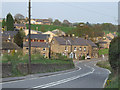
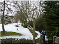

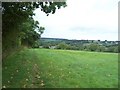
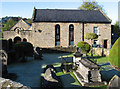
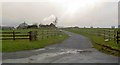
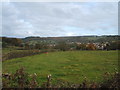
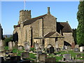

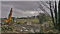
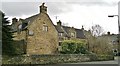
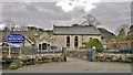
44 photos from this area
Area Information
Key information about the DE4 5FR including its size, population, and administrative classification.
- Area Type
- Postcode
- Area Size
- 33.6 hectares
- Population
- 1176
- Population Density
- 241 people/km²
House Prices in DE4 5FR
35
Properties
£317,200
Average Sold Price
£30,000
Lowest Price
£1,007,000
Highest Price
Showing 35 properties
| Address | Type | Beds | Baths | Last Sale Price | Last Sale Date | |
|---|---|---|---|---|---|---|
| Rotherwood, Nottingham Road, Tansley, DE4 5FR | Detached | 4 | 3 | £1,007,000 | Mar 2023 | |
| Dove Cottage, Nottingham Road, Tansley, DE4 5FR | Cottage | 3 | 2 | £223,000 | Sep 2022 | |
| 2, Brookside Cottages, Nottingham Road, Tansley, DE4 5FR | Detached | 2 | 1 | £155,000 | Sep 2021 | |
| Cunnery View, Nottingham Road, Tansley, DE4 5FR | Semi-detached | 3 | 1 | £289,995 | Jul 2020 | |
| Korna House, Nottingham Road, Tansley, DE4 5FR | Cottage | 3 | 1 | £135,000 | Jun 2019 | |
| The Homestead, Nottingham Road, Tansley, DE4 5FR | Detached | 4 | 2 | £310,000 | Jan 2018 | |
| Croft House, Nottingham Road, Tansley, DE4 5FR | Detached | 5 | - | £30,000 | Jul 2017 | |
| The Croft, Nottingham Road, Tansley, DE4 5FR | Bungalow | 3 | 1 | £287,000 | Mar 2017 | |
| Heathy Lea House, Nottingham Road, Tansley, DE4 5FR | house | - | - | £560,000 | Jul 2013 | |
| Hest Bank, Nottingham Road, Tansley, DE4 5FR | Bungalow | 3 | 1 | £175,000 | Dec 2009 |
Page 1 of 4
Energy Efficiency in DE4 5FR
Amenities
Schools
| Rank | School | Type | Entry gender | Ages |
|---|
Explore more schools in this area
Go to Schools tabDemographics
Household Size
Two person
most common
Accommodation Type
Houses
most common
Tenure
80
majority
Ethnic Group
White
most common
Religion
N/A
most common
Household Composition
N/A
most common
Age
47
median
Adults (30-64 years)
most common
Household Deprivation
N/A
with no deprivation
NS-SEC
41
in Lower managerial occupations
Explore more demographic insights in this area
Go to Demographics tabPlanning
Planning Constraints
- Flood RiskPremium
- Ramsar Wetland SitesPremium
- Area of Outstanding Natural BeautyPremium
- Protected Nature ReservePremium
- Protected WoodlandPremium