Area Overview for DE4 4LU
Photos of DE4 4LU
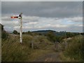
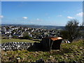
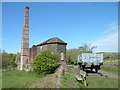
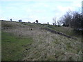
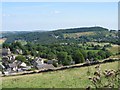
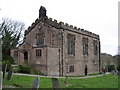
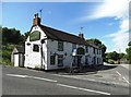
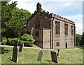


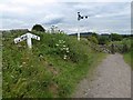
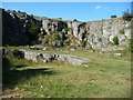
102 photos from this area
Area Information
Key information about the DE4 4LU including its size, population, and administrative classification.
- Area Type
- Postcode
- Area Size
- 3.1 hectares
- Population
- 1542
- Population Density
- 180 people/km²
House Prices in DE4 4LU
30
Properties
£226,281
Average Sold Price
£6,000
Lowest Price
£455,000
Highest Price
Showing 30 properties
| Address | Type | Beds | Baths | Last Sale Price | Last Sale Date | |
|---|---|---|---|---|---|---|
| The Nook, 42 Main Street, Middleton By Wirksworth, DE4 4LU | house | 3 | 1 | £360,000 | Mar 2025 | |
| 49 Main Street, Middleton By Wirksworth, DE4 4LU | Cottage | 2 | 1 | £212,000 | Feb 2024 | |
| Craven Cottage, 35 Main Street, Middleton By Wirksworth, DE4 4LU | house | 3 | 1 | £272,500 | Jan 2024 | |
| 45A Main Street, Middleton By Wirksworth, DE4 4LU | house | 3 | 1 | £265,000 | Aug 2023 | |
| Amber Cottage, 53 Main Street, Middleton By Wirksworth, DE4 4LU | house | 3 | 1 | £399,000 | Dec 2022 | |
| 51 MAIN STREET, Middleton by Wirksworth, DE4 4LU | Retail | 4 | 2 | £380,000 | Nov 2022 | |
| 34A Main Street, Middleton By Wirksworth, DE4 4LU | Detached | 3 | 1 | £260,000 | Mar 2022 | |
| 50 Main Street, Middleton By Wirksworth, DE4 4LU | house | - | - | £335,000 | Feb 2022 | |
| Alport View, 59 Main Street, Middleton By Wirksworth, DE4 4LU | Cottage | 2 | 1 | £182,500 | Oct 2020 | |
| 48 Main Street, Middleton By Wirksworth, DE4 4LU | house | - | - | £389,950 | Aug 2020 |
Page 1 of 3
Energy Efficiency in DE4 4LU
Amenities
Schools
| Rank | School | Type | Entry gender | Ages |
|---|
Explore more schools in this area
Go to Schools tabDemographics
Household Size
Two person
most common
Accommodation Type
Houses
most common
Tenure
78
majority
Ethnic Group
White
most common
Religion
N/A
most common
Household Composition
N/A
most common
Age
47
median
Adults (30-64 years)
most common
Household Deprivation
N/A
with no deprivation
NS-SEC
38
in Lower managerial occupations
Explore more demographic insights in this area
Go to Demographics tabPlanning
Planning Constraints
- Flood RiskPremium
- Ramsar Wetland SitesPremium
- Area of Outstanding Natural BeautyPremium
- Protected Nature ReservePremium
- Protected WoodlandPremium