Area Overview for DE4 3HF
Photos of DE4 3HF
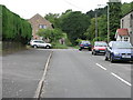
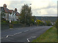
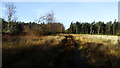
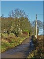
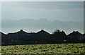
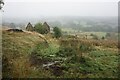
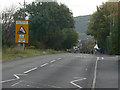
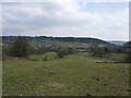
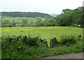
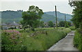
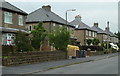
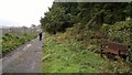
25 photos from this area
Area Information
Key information about the DE4 3HF including its size, population, and administrative classification.
- Area Type
- Postcode
- Area Size
- 5.2 hectares
- Population
- 1399
- Population Density
- 392 people/km²
House Prices in DE4 3HF
36
Properties
£201,414
Average Sold Price
£90,000
Lowest Price
£322,500
Highest Price
Showing 36 properties
| Address | Type | Beds | Baths | Last Sale Price | Last Sale Date | |
|---|---|---|---|---|---|---|
| 10 Moorfield, Matlock, DE4 3HF | Semi-detached | 4 | 2 | £322,500 | May 2023 | |
| 33 Moorfield, Matlock, DE4 3HF | Retail | 3 | 1 | £320,000 | May 2022 | |
| 14 Moorfield, Matlock, DE4 3HF | Semi-detached | 6 | 3 | £290,000 | Nov 2020 | |
| 19 Moorfield, Matlock, DE4 3HF | Semi-detached | 3 | 1 | £200,000 | Sep 2020 | |
| 15 Moorfield, Matlock, DE4 3HF | Semi-detached | 3 | 1 | £175,000 | Jul 2017 | |
| 8 Moorfield, Matlock, DE4 3HF | Semi-detached | 3 | 1 | £185,000 | Sep 2014 | |
| 5 Moorfield, Matlock, DE4 3HF | Bungalow | - | - | £159,000 | May 2014 | |
| 35 Moorfield, Matlock, DE4 3HF | house | 4 | - | £174,500 | Nov 2013 | |
| 21 Moorfield, Matlock, DE4 3HF | house | - | - | £155,000 | Sep 2013 | |
| 22 Moorfield, Matlock, DE4 3HF | Bungalow | - | - | £280,000 | Jun 2013 |
Page 1 of 4
Energy Efficiency in DE4 3HF
Amenities
Schools
| Rank | School | Type | Entry gender | Ages |
|---|
Explore more schools in this area
Go to Schools tabDemographics
Household Size
Two person
most common
Accommodation Type
Houses
most common
Tenure
79
majority
Ethnic Group
White
most common
Religion
N/A
most common
Household Composition
N/A
most common
Age
47
median
Adults (30-64 years)
most common
Household Deprivation
N/A
with no deprivation
NS-SEC
43
in Lower managerial occupations
Explore more demographic insights in this area
Go to Demographics tabPlanning
Planning Constraints
- Flood RiskPremium
- Ramsar Wetland SitesPremium
- Area of Outstanding Natural BeautyPremium
- Protected Nature ReservePremium
- Protected WoodlandPremium