Area Overview for DE4 3FN
Photos of DE4 3FN
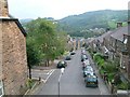

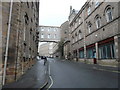

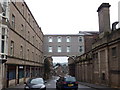
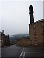
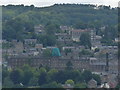

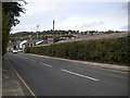
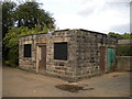
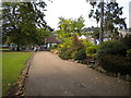

82 photos from this area
Area Information
Key information about the DE4 3FN including its size, population, and administrative classification.
- Area Type
- Postcode
- Area Size
- 1767 m²
- Population
- 1399
- Population Density
- 392 people/km²
House Prices in DE4 3FN
16
Properties
£165,630
Average Sold Price
£139,550
Lowest Price
£210,000
Highest Price
Showing 16 properties
| Address | Type | Beds | Baths | Last Sale Price | Last Sale Date | |
|---|---|---|---|---|---|---|
| 6, Cavendish Apartments, Cavendish Road, Matlock, DE4 3FN | Flat | 2 | 2 | £178,000 | Mar 2025 | |
| 14, Cavendish Apartments, Cavendish Road, Matlock, DE4 3FN | Flat | - | - | £210,000 | Jul 2022 | |
| 3, Cavendish Apartments, Cavendish Road, Matlock, DE4 3FN | Flat | 2 | 2 | £175,000 | May 2022 | |
| 16, Cavendish Apartments, Cavendish Road, Matlock, DE4 3FN | Flat | - | - | £167,000 | Nov 2019 | |
| 7, Cavendish Apartments, Cavendish Road, Matlock, DE4 3FN | Flat | - | - | £145,000 | Oct 2019 | |
| 5, Cavendish Apartments, Cavendish Road, Matlock, DE4 3FN | Flat | - | - | £157,000 | Jun 2018 | |
| 9, Cavendish Apartments, Cavendish Road, Matlock, DE4 3FN | Flat | 2 | 2 | £145,000 | Jan 2018 | |
| 12, Cavendish Apartments, Cavendish Road, Matlock, DE4 3FN | Flat | 2 | 2 | £170,000 | Mar 2017 | |
| 11, Cavendish Apartments, Cavendish Road, Matlock, DE4 3FN | Flat | - | - | £153,000 | Jan 2017 | |
| 1, Cavendish Apartments, Cavendish Road, Matlock, DE4 3FN | Flat | - | - | £139,550 | Oct 2016 |
Page 1 of 2
Energy Efficiency in DE4 3FN
Amenities
Schools
| Rank | School | Type | Entry gender | Ages |
|---|
Explore more schools in this area
Go to Schools tabDemographics
Household Size
Two person
most common
Accommodation Type
Houses
most common
Tenure
79
majority
Ethnic Group
White
most common
Religion
N/A
most common
Household Composition
N/A
most common
Age
47
median
Adults (30-64 years)
most common
Household Deprivation
N/A
with no deprivation
NS-SEC
43
in Lower managerial occupations
Explore more demographic insights in this area
Go to Demographics tabPlanning
Planning Constraints
- Flood RiskPremium
- Ramsar Wetland SitesPremium
- Area of Outstanding Natural BeautyPremium
- Protected Nature ReservePremium
- Protected WoodlandPremium