Area Overview for DE4 2QH
Photos of DE4 2QH
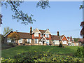
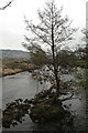
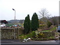
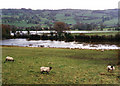
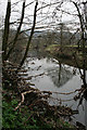
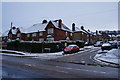
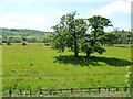
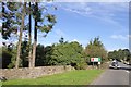
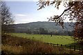
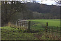
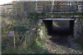
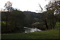
48 photos from this area
Area Information
Key information about the DE4 2QH including its size, population, and administrative classification.
- Area Type
- Postcode
- Area Size
- 6.2 hectares
- Population
- 2598
- Population Density
- 408 people/km²
House Prices in DE4 2QH
43
Properties
£179,753
Average Sold Price
£32,162
Lowest Price
£303,000
Highest Price
Showing 43 properties
| Address | Type | Beds | Baths | Last Sale Price | Last Sale Date | |
|---|---|---|---|---|---|---|
| Vinelea, Darley House Estate, Hackney, DE4 2QH | Semi-detached | 2 | 1 | £230,000 | Feb 2025 | |
| Sunnyside, Darley House Estate, Hackney, DE4 2QH | Detached | 3 | 1 | £280,000 | May 2021 | |
| Newbury, Darley House Estate, Hackney, DE4 2QH | Detached | 3 | 1 | £303,000 | Oct 2020 | |
| 20 Darley House Estate, Hackney, DE4 2QH | Semi-detached | 3 | 1 | £134,995 | Jun 2019 | |
| Sunninglea, Darley House Estate, Hackney, DE4 2QH | Bungalow | 2 | 1 | £184,500 | May 2017 | |
| 1 Darley House Estate, Hackney, DE4 2QH | Semi-detached | 3 | 1 | £135,000 | Aug 2016 | |
| Glenville, Darley House Estate, Hackney, DE4 2QH | Semi-detached | 2 | - | £210,000 | Sep 2015 | |
| Overhills, Darley House Estate, Hackney, DE4 2QH | Bungalow | 3 | 1 | £185,000 | Aug 2015 | |
| Southlea, Darley House Estate, Hackney, DE4 2QH | Semi-detached | 4 | 2 | £206,000 | May 2015 | |
| Clovelly, Darley House Estate, Hackney, DE4 2QH | Semi-detached | 3 | 1 | £119,950 | Feb 2015 |
Page 1 of 5
Energy Efficiency in DE4 2QH
Amenities
Schools
| Rank | School | Type | Entry gender | Ages |
|---|
Explore more schools in this area
Go to Schools tabDemographics
Household Size
Two person
most common
Accommodation Type
Houses
most common
Tenure
80
majority
Ethnic Group
White
most common
Religion
N/A
most common
Household Composition
N/A
most common
Age
47
median
Adults (30-64 years)
most common
Household Deprivation
N/A
with no deprivation
NS-SEC
40
in Lower managerial occupations
Explore more demographic insights in this area
Go to Demographics tabPlanning
Planning Constraints
- Flood RiskPremium
- Ramsar Wetland SitesPremium
- Area of Outstanding Natural BeautyPremium
- Protected Nature ReservePremium
- Protected WoodlandPremium