Area Overview for DE4 2HS
Photos of DE4 2HS
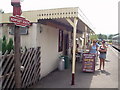
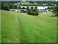
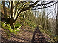
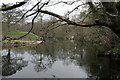
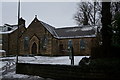
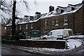
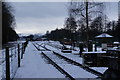
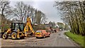
69 photos from this area
Area Information
Key information about the DE4 2HS including its size, population, and administrative classification.
- Area Type
- Postcode
- Area Size
- 11.0 hectares
- Population
- 1818
- Population Density
- 108 people/km²
House Prices in DE4 2HS
28
Properties
£391,184
Average Sold Price
£105,000
Lowest Price
£635,000
Highest Price
Showing 28 properties
| Address | Type | Beds | Baths | Last Sale Price | Last Sale Date | |
|---|---|---|---|---|---|---|
| 101 Northwood Lane, Darley Dale, DE4 2HS | house | 4 | 2 | £635,000 | Nov 2024 | |
| 113 Northwood Lane, Darley Dale, DE4 2HS | house | 4 | 1 | £410,000 | Apr 2023 | |
| 104 Northwood Lane, Darley Dale, DE4 2HS | Semi-detached | 3 | 1 | £270,000 | Sep 2020 | |
| 122 Northwood Lane, Darley Dale, DE4 2HS | Bungalow | 3 | 1 | £310,000 | Jan 2020 | |
| Northwood Farm, Northwood Lane, Darley Dale, DE4 2HS | Detached | 4 | 2 | £412,000 | Aug 2019 | |
| 106 Northwood Lane, Darley Dale, DE4 2HS | Semi-detached | 5 | 1 | £299,950 | Aug 2017 | |
| 116 Northwood Lane, Darley Dale, DE4 2HS | Bungalow | 4 | 1 | £348,500 | Jul 2017 | |
| Hilltop House, Northwood Lane, Darley Dale, DE4 2HS | Detached | 3 | 1 | £467,500 | Aug 2015 | |
| 111 Northwood Lane, Darley Dale, DE4 2HS | house | 3 | 1 | £105,000 | Jan 2014 | |
| 127 Northwood Lane, Darley Dale, DE4 2HS | Bungalow | - | - | £425,000 | Jan 2012 |
Page 1 of 3
Energy Efficiency in DE4 2HS
Amenities
Schools
| Rank | School | Type | Entry gender | Ages |
|---|
Explore more schools in this area
Go to Schools tabDemographics
Household Size
Two person
most common
Accommodation Type
Houses
most common
Tenure
73
majority
Ethnic Group
White
most common
Religion
N/A
most common
Household Composition
N/A
most common
Age
47
median
Adults (30-64 years)
most common
Household Deprivation
N/A
with no deprivation
NS-SEC
37
in Lower managerial occupations
Explore more demographic insights in this area
Go to Demographics tabPlanning
Planning Constraints
- Flood RiskPremium
- Ramsar Wetland SitesPremium
- Area of Outstanding Natural BeautyPremium
- Protected Nature ReservePremium
- Protected WoodlandPremium