Area Overview for DE4 2GG
Photos of DE4 2GG
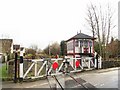
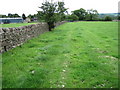
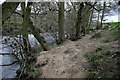
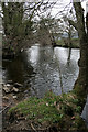
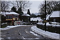
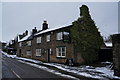
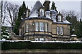
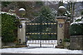
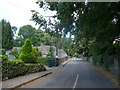
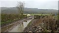
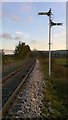
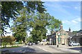
70 photos from this area
Area Information
Key information about the DE4 2GG including its size, population, and administrative classification.
- Area Type
- Postcode
- Area Size
- 3.0 hectares
- Population
- 1700
- Population Density
- 1107 people/km²
House Prices in DE4 2GG
23
Properties
£308,625
Average Sold Price
£147,250
Lowest Price
£475,000
Highest Price
Showing 23 properties
| Address | Type | Beds | Baths | Last Sale Price | Last Sale Date | |
|---|---|---|---|---|---|---|
| 4 Church Road, Darley Dale, DE4 2GG | Semi-detached | 3 | 1 | £388,000 | Mar 2025 | |
| Westering, Church Road, Darley Dale, DE4 2GG | Detached | 3 | 1 | £475,000 | Aug 2023 | |
| 5 Church Road, Darley Dale, DE4 2GG | Cottage | 2 | 1 | £390,000 | Jun 2023 | |
| West View, Church Road, Darley Dale, DE4 2GG | Semi-detached | 2 | 1 | £240,000 | Mar 2022 | |
| The Carriages, 8 Church Road, Darley Dale, DE4 2GG | Detached | 5 | 4 | £430,000 | Oct 2018 | |
| 3 Church Road, Darley Dale, DE4 2GG | Semi-detached | 2 | 1 | £205,000 | May 2016 | |
| 6 Church Road, Darley Dale, DE4 2GG | house | - | - | £182,000 | Dec 2012 | |
| Sunnyville, Church Road, Darley Dale, DE4 2GG | Detached | 4 | 1 | £244,000 | Dec 2012 | |
| Lyme Close House, Church Road, Darley Dale, DE4 2GG | Detached | - | - | £385,000 | Sep 2008 | |
| 1 Church Road, Darley Dale, DE4 2GG | Semi-detached | - | - | £147,250 | Jun 2007 |
Page 1 of 3
Energy Efficiency in DE4 2GG
Amenities
Schools
| Rank | School | Type | Entry gender | Ages |
|---|
Explore more schools in this area
Go to Schools tabDemographics
Household Size
Two person
most common
Accommodation Type
Houses
most common
Tenure
57
majority
Ethnic Group
White
most common
Religion
N/A
most common
Household Composition
N/A
most common
Age
47
median
Adults (30-64 years)
most common
Household Deprivation
N/A
with no deprivation
NS-SEC
25
in Lower managerial occupations
Explore more demographic insights in this area
Go to Demographics tabPlanning
Planning Constraints
- Flood RiskPremium
- Ramsar Wetland SitesPremium
- Area of Outstanding Natural BeautyPremium
- Protected Nature ReservePremium
- Protected WoodlandPremium