Area Overview for DE4 2EH
Photos of DE4 2EH
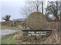
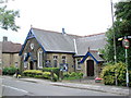
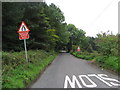
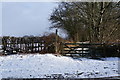
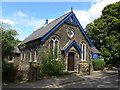
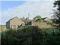
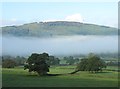
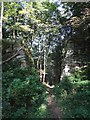
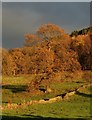
47 photos from this area
Area Information
Key information about the DE4 2EH including its size, population, and administrative classification.
- Area Type
- Postcode
- Area Size
- 16.2 hectares
- Population
- 1818
- Population Density
- 108 people/km²
House Prices in DE4 2EH
19
Properties
£342,167
Average Sold Price
£225,000
Lowest Price
£465,000
Highest Price
Showing 19 properties
| Address | Type | Beds | Baths | Last Sale Price | Last Sale Date | |
|---|---|---|---|---|---|---|
| 2, Stanton Villas, Chatsworth Road, Rowsley, DE4 2EH | Detached | 4 | 2 | £463,000 | Oct 2025 | |
| 1, Haddon Villas, Chatsworth Road, Rowsley, DE4 2EH | Semi-detached | 3 | 1 | £408,000 | Nov 2022 | |
| Sunnyside, Chatsworth Road, Rowsley, DE4 2EH | house | - | - | £287,500 | Nov 2019 | |
| Woodside, Chatsworth Road, Rowsley, DE4 2EH | Semi-detached | 3 | 1 | £267,000 | May 2016 | |
| Eastfield, Chatsworth Road, Rowsley, DE4 2EH | Detached | 5 | 2 | £355,000 | May 2016 | |
| Greenfields, Chatsworth Road, Rowsley, DE4 2EH | house | - | - | £277,500 | Aug 2012 | |
| Cambrian House, Chatsworth Road, Rowsley, DE4 2EH | house | - | - | £435,000 | Apr 2011 | |
| Woodville, Chatsworth Road, Rowsley, DE4 2EH | house | 5 | 3 | £280,000 | Mar 2010 | |
| North House, Chatsworth Road, Rowsley, DE4 2EH | house | - | - | £465,000 | Feb 2010 | |
| The Owls Nest, Chatsworth Road, Rowsley, DE4 2EH | house | - | - | £293,000 | Mar 2009 |
Page 1 of 2
Energy Efficiency in DE4 2EH
Amenities
Schools
| Rank | School | Type | Entry gender | Ages |
|---|
Explore more schools in this area
Go to Schools tabDemographics
Household Size
Two person
most common
Accommodation Type
Houses
most common
Tenure
73
majority
Ethnic Group
White
most common
Religion
N/A
most common
Household Composition
N/A
most common
Age
47
median
Adults (30-64 years)
most common
Household Deprivation
N/A
with no deprivation
NS-SEC
37
in Lower managerial occupations
Explore more demographic insights in this area
Go to Demographics tabPlanning
Planning Constraints
- Flood RiskPremium
- Ramsar Wetland SitesPremium
- Area of Outstanding Natural BeautyPremium
- Protected Nature ReservePremium
- Protected WoodlandPremium