Area Overview for DE4 1AE
Photos of DE4 1AE
Area Information
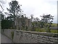
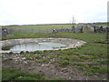
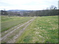
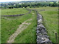
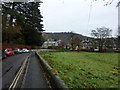
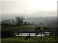
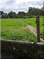
Living in DE4 1AE means being part of a small, tightly knit residential cluster in England’s Derbyshire countryside. With a population of 1,360 spread over a low-density area of 76 people per square kilometre, this postcode feels more like a village than a city suburb. The community is characterised by a quiet, settled rhythm, with most residents aged between 30 and 64. Daily life here is defined by proximity to nature, with no major urban centres nearby but easy access to local amenities. The area’s compact size means residents can walk or cycle to nearby shops, schools, and transport links. While it lacks the vibrancy of a bustling town, DE4 1AE offers a peaceful alternative for those prioritising space, safety, and a slower pace. Its small footprint also means the local character is easy to navigate, with no sprawling developments or complex infrastructure. For buyers seeking a home with low crime rates and minimal environmental constraints, this area provides a straightforward, low-maintenance lifestyle.
- Area Type
- Postcode
- Area Size
- Not available
- Population
- 1360
- Population Density
- 76 people/km²
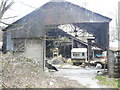
DE4 1AE is a predominantly owner-occupied area, with 82% of homes owned by their residents. The housing stock is almost entirely composed of houses, reflecting the area’s rural, low-density nature. This contrasts with urban areas where flats or apartments might dominate. The small size of the postcode means the property market is limited to a handful of homes, making it a niche market for buyers seeking a quiet, private residence. The high home ownership rate indicates that properties here are likely to be long-term investments rather than short-term rentals. Buyers should consider the limited availability of properties and the potential for slower price fluctuations compared to larger towns. The absence of major planning constraints, such as protected woodlands or AONBs, also means development restrictions are minimal, though the area’s small size limits expansion.
House Prices in DE4 1AE
No properties found in this postcode.
Energy Efficiency in DE4 1AE
The lifestyle in DE4 1AE is shaped by its proximity to local amenities, including five retail outlets such as Co-op Bakewell, Spar, and Aldi Ashford. These shops provide essential services like groceries and everyday goods, reducing the need for long trips. The area’s small size means residents can access these venues on foot or by short drive. While there are no named parks or leisure facilities in the data, the absence of planning constraints like protected woodlands suggests open spaces may be available nearby. The presence of metro and rail stations adds convenience, allowing access to larger towns for dining, entertainment, or specialist shopping. This balance of local convenience and regional connectivity supports a low-maintenance, community-focused lifestyle.
Amenities
Schools
The nearest school to DE4 1AE is Lady Manners School, a primary school with an Ofsted rating of 'good'. This provides a reliable option for families with young children, though no secondary schools are listed in the data. The presence of a primary school with a positive rating suggests a basic educational infrastructure, but parents seeking a broader range of schools may need to look further afield. The area’s small size means students might travel to nearby towns for secondary education. For families prioritising local schooling, Lady Manners School offers a solid foundation, but the lack of secondary options should be considered when evaluating the area’s long-term suitability for growing families.
| Rank | School | Type | Entry gender | Ages |
|---|
Explore more schools in this area
Go to Schools tabDemographics
The population of DE4 1AE is predominantly adults aged 30 to 64, with a median age of 47. This suggests a mature, stable community where many residents are likely to be established professionals or retired individuals. Home ownership is high, with 82% of properties occupied by their owners, indicating a strong sense of local attachment. The accommodation is almost entirely houses, rather than flats or apartments, which aligns with the area’s rural character. The predominant ethnic group is White, with no data provided on other demographics. The low population density of 76 people per square kilometre reinforces the area’s spacious, low-pressure environment. While no specific deprivation data is listed, the high home ownership and low crime risk suggest a generally secure, self-sufficient community.
Household Size
Accommodation Type
Tenure
Ethnic Group
Religion
Household Composition
Age
Household Deprivation
NS-SEC
Explore more demographic insights in this area
Go to Demographics tabPlanning
Planning Constraints
- Flood RiskPremium
- Ramsar Wetland SitesPremium
- Area of Outstanding Natural BeautyPremium
- Protected Nature ReservePremium
- Protected WoodlandPremium