Area Overview for DE3 9GS
Photos of DE3 9GS
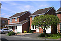
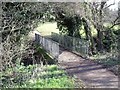
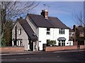
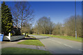
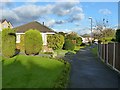
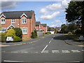
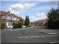
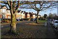
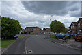
100 photos from this area
Area Information
Key information about the DE3 9GS including its size, population, and administrative classification.
- Area Type
- Postcode
- Area Size
- 1.0 hectares
- Population
- 2587
- Population Density
- 2517 people/km²
House Prices in DE3 9GS
25
Properties
£217,188
Average Sold Price
£53,500
Lowest Price
£318,000
Highest Price
Showing 25 properties
| Address | Type | Beds | Baths | Last Sale Price | Last Sale Date | |
|---|---|---|---|---|---|---|
| 153 Western Road, Mickleover, Derby, DE3 9GS | Semi-detached | 3 | 1 | £262,000 | Oct 2025 | |
| 134 Western Road, Mickleover, Derby, DE3 9GS | Semi-detached | 3 | 1 | £308,500 | Apr 2023 | |
| 151 Western Road, Mickleover, Derby, DE3 9GS | house | - | - | £280,000 | Aug 2022 | |
| 130 Western Road, Mickleover, Derby, DE3 9GS | Semi-detached | 4 | 3 | £318,000 | Oct 2021 | |
| 148 Western Road, Mickleover, Derby, DE3 9GS | house | - | - | £312,500 | May 2021 | |
| 136 Western Road, Mickleover, Derby, DE3 9GS | house | - | - | £210,000 | Mar 2020 | |
| 132 Western Road, Mickleover, Derby, DE3 9GS | Semi-detached | 3 | 1 | £236,000 | Nov 2019 | |
| 150 Western Road, Mickleover, Derby, DE3 9GS | Semi-detached | 4 | 1 | £241,000 | Jun 2018 | |
| 149 Western Road, Mickleover, Derby, DE3 9GS | Detached | 4 | 1 | £237,500 | Dec 2016 | |
| 128 Western Road, Mickleover, Derby, DE3 9GS | Semi-detached | 3 | - | £180,000 | Jul 2015 |
Page 1 of 3
Energy Efficiency in DE3 9GS
Amenities
Schools
| Rank | School | Type | Entry gender | Ages |
|---|
Explore more schools in this area
Go to Schools tabDemographics
Household Size
Family (3-5 people)
most common
Accommodation Type
Houses
most common
Tenure
75
majority
Ethnic Group
White
most common
Religion
N/A
most common
Household Composition
N/A
most common
Age
47
median
Adults (30-64 years)
most common
Household Deprivation
N/A
with no deprivation
NS-SEC
43
in Lower managerial occupations
Explore more demographic insights in this area
Go to Demographics tabPlanning
Planning Constraints
- Flood RiskPremium
- Ramsar Wetland SitesPremium
- Area of Outstanding Natural BeautyPremium
- Protected Nature ReservePremium
- Protected WoodlandPremium