Area Overview for DE3 8JR
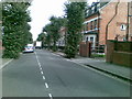
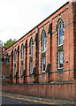
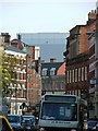
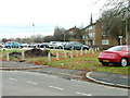
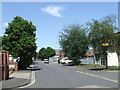
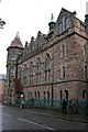
Photos of DE3 8JR


Area Information
Living in DE3 8JR means being part of a small, tightly knit residential cluster in Derby, a city in the East Midlands. With a population of just 1,269, this area offers a quiet, low-density lifestyle close to Derby’s central amenities. The proximity to Derby Arboretum, a historic park opened in 1840, adds a unique green space for residents to enjoy. The area is defined by its residential character, with a focus on flats rather than larger homes, reflecting its compact nature. Nearby, Derby Railway Station and other local stations provide easy access to commuting routes, while shops like Tesco Derby and Lidl Normanton cater to daily needs. The community here is predominantly adults aged 30–64, creating a mature demographic that values stability and proximity to essential services. While the area lacks the density of a bustling urban core, its blend of historic green spaces and practical connectivity makes it appealing for those seeking a balanced lifestyle.
- Area Type
- Postcode
- Area Size
- Not available
- Population
- 1269
- Population Density
- 3640 people/km²
The property market in DE3 8JR is characterised by a low home ownership rate of 19%, suggesting that the area is primarily a rental market rather than one dominated by owner-occupied homes. The accommodation type is predominantly flats, which is typical for smaller, urbanised residential clusters. This configuration may appeal to those seeking affordable, low-maintenance housing, though it limits opportunities for buyers looking for larger properties or long-term investment. The small size of the area means housing stock is limited, and the surrounding neighbourhoods may offer more options for those exploring nearby. For buyers, the market is likely to be competitive, with properties prioritised for their proximity to amenities like Derby Arboretum and rail links. However, the flat-dominated landscape may not suit those preferring detached homes or larger family residences.
House Prices in DE3 8JR
No properties found in this postcode.
Energy Efficiency in DE3 8JR
Residents of DE3 8JR benefit from a range of nearby amenities that enhance daily life. The area is within walking distance of shops such as Tesco Derby, Lidl Normanton, and M&S Derby, providing convenience for grocery and retail needs. The proximity to Derby Railway Station and other local stations adds to the area’s accessibility, making it easy to commute to Derby’s city centre or beyond. The Derby Arboretum, a historic park opened in 1840, offers a significant recreational asset, with landscaped gardens, ponds, and open spaces for leisure activities. This blend of practical retail, transport links, and green space creates a balanced lifestyle, combining urban convenience with natural tranquillity. The presence of a nursery and primary school further supports families, ensuring essential services are within reach.
Amenities
Schools
Residents of DE3 8JR have access to a range of educational institutions, including Beechwood Nursery School, which provides early years education. For primary schooling, St James’ Church of England Aided Junior School serves the area, offering both a traditional primary school model and an academy designation. The latter has an Ofsted rating of ‘good’, indicating a solid standard of education. The presence of a nursery and a primary school with a positive rating is a significant advantage for families, ensuring children have access to early education and a well-regarded primary phase. However, the data does not specify secondary schools in the immediate vicinity, meaning families may need to look further afield for secondary education. The mix of school types reflects a balance between established institutions and modern educational structures.
| Rank | School | Type | Entry gender | Ages |
|---|
Explore more schools in this area
Go to Schools tabDemographics
The demographic profile of DE3 8JR is shaped by a median age of 47, with the majority of residents falling within the 30–64 age range. This suggests a community of established professionals and families, rather than a younger or elderly population. Home ownership is relatively low, with only 19% of residents owning their homes, indicating that most properties in the area are rented. The predominant accommodation type is flats, which aligns with the area’s compact residential layout. The predominant ethnic group is White, reflecting the broader demographic trends in Derby. While specific data on deprivation is not provided, the low home ownership rate and flat-dominated housing stock may suggest a mix of long-term residents and renters. The absence of detailed diversity metrics means the community’s cultural composition remains less defined in the data.
Household Size
Accommodation Type
Tenure
Ethnic Group
Religion
Household Composition
Age
Household Deprivation
NS-SEC
Explore more demographic insights in this area
Go to Demographics tabPlanning
Planning Constraints
- Flood RiskPremium
- Ramsar Wetland SitesPremium
- Area of Outstanding Natural BeautyPremium
- Protected Nature ReservePremium
- Protected WoodlandPremium