Area Overview for DE3 3SY
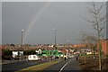
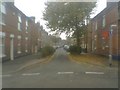
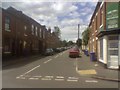
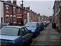
Photos of DE3 3SY


Area Information
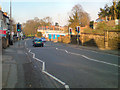
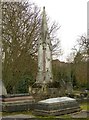
Living in DE3 3SY means being part of a small, tightly knit residential cluster in Derby, England. With a population of 1,795, this area is characterised by its quiet, low-density housing and proximity to nearby towns like Normanton. The postcode covers a mix of historic and modern dwellings, with a notable heritage including 15 listed buildings and locally protected structures such as No. 48 Bedford Street. Daily life here balances suburban tranquillity with access to essential services. The area’s compact size means residents are within walking or cycling distance of key amenities, while its location in Derbyshire offers a blend of urban convenience and natural surroundings. Though small, DE3 3SY is strategically placed near Derby’s railway network, providing links to larger cities. The community reflects a mature demographic, with adults aged 30–64 forming the majority. While the area lacks large-scale commercial hubs, its charm lies in its simplicity and the preserved architectural character that gives it a distinct local identity.
- Area Type
- Postcode
- Area Size
- Not available
- Population
- 1795
- Population Density
- 7992 people/km²
The property market in DE3 3SY is defined by its low home ownership rate of 18%, which is significantly below the national average. This suggests that the area is more reliant on rental properties than owner-occupied homes. The predominant accommodation type is houses, which is noteworthy for a small postcode area, indicating a mix of single-family homes and possibly smaller detached properties. This housing stock may appeal to families or individuals seeking private, low-density living. However, the limited data on property types or prices means buyers must consider the broader Derby region for comparison. The small size of the area means that the local market is tightly bound to nearby towns like Normanton, where additional housing options may be available. For buyers, the challenge lies in the limited supply of homes for sale, which could drive competition in the local rental market. The focus on houses rather than flats or apartments also means the area may not cater to those seeking high-density or urban living.
House Prices in DE3 3SY
No properties found in this postcode.
Energy Efficiency in DE3 3SY
Residents of DE3 3SY enjoy a range of nearby amenities that support a practical, community-oriented lifestyle. Five retail outlets, including Sainsburys Farm, Aldi Normanton, and Lidl Normanton, provide everyday shopping options, while five railway stations—such as Derby, Peartree, and Spondon—offer direct links to Derby’s city centre and regional transport hubs. The area’s compact size means these amenities are within walking or cycling distance for many residents. Though the data does not specify parks or leisure facilities, the presence of listed buildings and historic sites like No. 48 Bedford Street suggests a blend of heritage and modern convenience. The retail and rail connectivity contribute to a self-contained lifestyle, reducing the need for long commutes. However, the absence of detailed information on leisure options means potential buyers should explore nearby towns for additional facilities. The area’s character is defined by its accessibility and the balance between suburban tranquillity and urban connectivity.
Amenities
Schools
The nearest school to DE3 3SY is Becket Primary School, a primary education institution with a good Ofsted rating. This single school serves the local community, providing a foundation for young learners in the area. The absence of secondary schools or further education institutions within the postcode means students may need to travel to nearby towns for secondary education. For families prioritising proximity to schools, Becket Primary’s good rating is a positive factor, though the lack of additional educational facilities could be a limitation. The school’s presence suggests that the area is family-friendly, but the need to commute for higher education may influence decisions for larger families. The single school also means the community is smaller, with limited options for extracurricular activities or specialist provision. Parents should consider the broader Derby region for secondary schooling, as no data on nearby secondary schools is provided.
| Rank | School | Type | Entry gender | Ages |
|---|
Explore more schools in this area
Go to Schools tabDemographics
The population of DE3 3SY is 1,795, with a median age of 47, indicating a predominantly adult community. The most common age range is 30–64 years, suggesting a stable, middle-aged demographic. Home ownership is relatively low at 18%, implying a higher proportion of renters compared to owner-occupiers. The primary accommodation type is houses, which is unusual for a postcode of this size, hinting at a mix of family homes and smaller properties. The predominant ethnic group is White, with no data provided on other ethnicities. This demographic profile suggests a community focused on long-term stability rather than transient populations. The low home ownership rate may reflect economic factors or a preference for rental living in a small, mature area. The absence of specific data on deprivation or diversity means the quality of life is inferred from the available figures, but the age profile and housing stock suggest a quiet, low-maintenance lifestyle.
Household Size
Accommodation Type
Tenure
Ethnic Group
Religion
Household Composition
Age
Household Deprivation
NS-SEC
Explore more demographic insights in this area
Go to Demographics tabPlanning
Planning Constraints
- Flood RiskPremium
- Ramsar Wetland SitesPremium
- Area of Outstanding Natural BeautyPremium
- Protected Nature ReservePremium
- Protected WoodlandPremium