Area Overview for DE3 3BJ
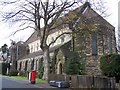
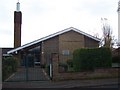
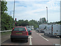
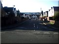
Photos of DE3 3BJ


Area Information
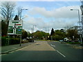
Living in DE3 3BJ means being part of a small, tightly knit residential cluster in Derby, England. This postcode area, part of Darley Ward, sits along the River Derwent, a historic waterway that once powered the industrial heart of the Derwent Valley Mills World Heritage Site. The area’s past as a planned mill village is still visible in its terraced housing and clustered layout, a legacy of the 18th-century Evans family’s development. With a population of 1,942, DE3 3BJ is a compact community where daily life is shaped by proximity to both historical landmarks and modern amenities. The area’s compact size means residents can walk to nearby shops, rail stations, and schools, while its location within Derby offers access to the city’s cultural and economic hubs. Though small, DE3 3BJ reflects a blend of heritage and practicality, with a young demographic and a focus on rental housing. For those seeking a mix of history and convenience, this area offers a distinct character that stands out in Derby’s urban landscape.
- Area Type
- Postcode
- Area Size
- Not available
- Population
- 1942
- Population Density
- 5467 people/km²
The property market in DE3 3BJ is characterised by a high reliance on rental housing, with only 26% of residents owning their homes. The accommodation type is predominantly flats, suggesting a focus on smaller, often shared living spaces. This configuration is typical of areas with a young, transient population, such as students or those working in Derby’s city centre. The limited home ownership rate means the market is likely dominated by private landlords and rental agencies, which may influence availability and competition for properties. For buyers, the small area’s compact nature means opportunities are limited to nearby developments or conversions of existing flats. The presence of flats also implies a need for proximity to public transport, as car ownership may be less common. Prospective buyers should consider the area’s rental-heavy profile when assessing long-term investment potential or lifestyle suitability.
House Prices in DE3 3BJ
No properties found in this postcode.
Energy Efficiency in DE3 3BJ
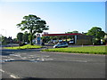
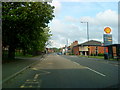
Daily life in DE3 3BJ is shaped by its proximity to essential amenities and practical retail options. The area’s five nearby retail outlets, including major supermarkets like Co-op, Asda, and Sainsburys, ensure residents have easy access to groceries, household goods, and other necessities. Rail connectivity is robust, with five stations within reach, facilitating travel to Derby’s city centre, surrounding towns, and regional hubs. While the data does not mention parks or leisure facilities, the area’s historical ties to the River Derwent suggest potential for walking or cycling along its banks. The compact nature of DE3 3BJ means residents can access these amenities without long commutes, fostering a lifestyle that balances convenience with the character of a small, historic community. The mix of retail and transport options supports a practical, everyday rhythm, though those seeking extensive leisure facilities may need to look further afield.
Amenities
Schools
Residents of DE3 3BJ have access to a range of school types, including a nursery, a special needs school, and an independent institution. Whitecross Nursery School provides early education, while the Royal School for the Deaf Derby caters to students with hearing impairments. Secret Garden, an independent school, offers alternative educational pathways. This mix allows families to choose between state-funded options and private institutions, though the absence of comprehensive data on Ofsted ratings means parents must conduct their own evaluations. The presence of a special school highlights the area’s accessibility for children with specific needs, while the independent school may appeal to those seeking non-traditional education. However, the limited number of schools suggests that families may need to travel beyond DE3 3BJ for secondary education or broader curriculum options.
| Rank | School | Type | Entry gender | Ages |
|---|
Explore more schools in this area
Go to Schools tabDemographics
DE3 3BJ has a median age of 22, with the most common age range being 15–29 years. This suggests a community skewed toward young adults, likely students or early-career professionals. Only 26% of residents own their homes, indicating a predominantly rental market, which aligns with the accommodation type listed as flats. This high proportion of rented properties and young occupants may reflect student housing or transient employment patterns. The predominant ethnic group is White, though no specific data on diversity beyond this is provided. The low home ownership rate could imply limited long-term investment in property, which may affect local property values and community stability. For quality of life, the youth-driven demographic may foster a dynamic, social environment but could also mean fewer family-oriented amenities compared to areas with older populations.
Household Size
Accommodation Type
Tenure
Ethnic Group
Religion
Household Composition
Age
Household Deprivation
NS-SEC
Explore more demographic insights in this area
Go to Demographics tabPlanning
Planning Constraints
- Flood RiskPremium
- Ramsar Wetland SitesPremium
- Area of Outstanding Natural BeautyPremium
- Protected Nature ReservePremium
- Protected WoodlandPremium