Area Overview for DE3 2LW
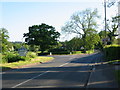
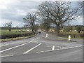
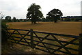
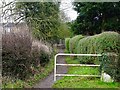
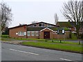
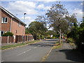
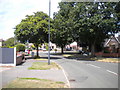
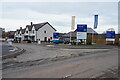
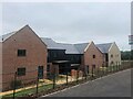
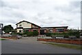
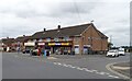
Photos of DE3 2LW

Area Information
Living in DE3 2LW offers a compact, residential experience shaped by its small cluster of homes and low population of 1,616 residents. This area is characterised by a mature demographic, with a median age of 47 and most residents falling within the 30-64 age range. The high home ownership rate of 92% suggests a stable, long-term community, with houses forming the primary accommodation type. Daily life here is likely quiet and neighbourly, with easy access to nearby amenities. The area’s safety profile is strong, with a crime risk score of 83, indicating below-average crime rates. Residents benefit from excellent broadband connectivity, scoring 100, and practical access to railway stations, including Derby and Duffield, which link to major cities. Schools like Woodlands School and Allsetree Woodlands Academy are within reach, adding to the appeal for families. While the area is small, its mix of retail options and transport links ensures convenience without the hustle of larger urban centres.
- Area Type
- Postcode
- Area Size
- Not available
- Population
- 1616
- Population Density
- 3645 people/km²
The property market in DE3 2LW is defined by a high rate of home ownership (92%) and a focus on houses rather than flats or apartments. This suggests a community where long-term residency is common, with properties likely being family homes passed through generations. The small size of the area means the housing stock is limited, but the high ownership rate indicates strong demand for existing properties. Buyers should expect a market where competition for homes may be intense, given the scarcity of new developments. The absence of rental properties implies that the area is not a hotspot for investors seeking lettings, but rather a place where residents prioritise ownership. For those considering purchase, the compact nature of DE3 2LW means that properties are likely to be in close proximity to amenities and transport links, offering a blend of convenience and stability.
House Prices in DE3 2LW
No properties found in this postcode.
Energy Efficiency in DE3 2LW
The lifestyle in DE3 2LW is shaped by its proximity to essential amenities within walking or short driving distance. Retail options include Tesco Allestree, Co-op Blenheim, and Co-op Kedleston, providing access to groceries, household goods, and everyday essentials. These shops cater to the needs of a small, settled community, ensuring convenience without the need for long trips. The area’s railway stations—Duffield, Derby, and Peartree—offer links to urban centres, enhancing accessibility for shopping, dining, or leisure beyond the immediate vicinity. While the area itself is small, its amenities suggest a practical, low-maintenance lifestyle, where daily needs are met locally. The absence of larger leisure facilities means residents may seek entertainment in nearby towns, but the compact nature of DE3 2LW ensures a quiet, self-contained environment with minimal disruption.
Amenities
Schools
Residents of DE3 2LW have access to two schools within practical reach. Woodlands School is a primary school, providing education for younger children, while Allsetree Woodlands School is an academy with an Ofsted rating of ‘good’. This mix of school types ensures families can access both early education and secondary-level schooling without long commutes. The presence of an academy suggests a focus on structured, possibly higher-standard education, which may appeal to parents seeking reliable academic provision. With a population of 1,616, the area’s schools are likely to serve a small but consistent number of pupils, ensuring a personalised learning environment. The combination of a primary school and an academy offers flexibility for families at different stages of their children’s education, reinforcing the area’s suitability for those prioritising schooling in their home search.
| Rank | School | Type | Entry gender | Ages |
|---|
Explore more schools in this area
Go to Schools tabDemographics
DE3 2LW’s population of 1,616 is predominantly composed of adults aged 30-64, with a median age of 47. This suggests a mature, settled community, likely with a focus on family life and long-term residency. Home ownership is exceptionally high at 92%, indicating that most residents live in properties they own rather than rent. The accommodation type is exclusively houses, which aligns with the area’s small, residential character. The predominant ethnic group is White, reflecting a homogenous demographic. The absence of specific deprivation data means no direct insights into economic challenges, but the high home ownership and stable age profile suggest a relatively secure quality of life. The low population and high ownership rate also imply a close-knit community with limited turnover, fostering familiarity and continuity among residents.
Household Size
Accommodation Type
Tenure
Ethnic Group
Religion
Household Composition
Age
Household Deprivation
NS-SEC
Explore more demographic insights in this area
Go to Demographics tabPlanning
Planning Constraints
- Flood RiskPremium
- Ramsar Wetland SitesPremium
- Area of Outstanding Natural BeautyPremium
- Protected Nature ReservePremium
- Protected WoodlandPremium