Area Overview for DE3 0AP
Photos of DE3 0AP
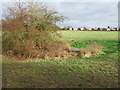
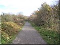
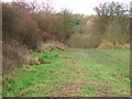
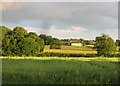
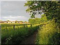
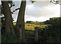
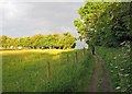
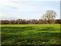
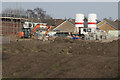
85 photos from this area
Area Information
Key information about the DE3 0AP including its size, population, and administrative classification.
- Area Type
- Postcode
- Area Size
- 6488 m²
- Population
- 2887
- Population Density
- 118 people/km²
House Prices in DE3 0AP
29
Properties
£268,512
Average Sold Price
£199,496
Lowest Price
£453,090
Highest Price
Showing 29 properties
| Address | Type | Beds | Baths | Last Sale Price | Last Sale Date | |
|---|---|---|---|---|---|---|
| 1 Regents Drive, Mickleover, Derby, DE3 0AP | Detached | 4 | 3 | £350,000 | Aug 2025 | |
| 41 Regents Drive, Mickleover, Derby, DE3 0AP | Semi-detached | 3 | 2 | £245,000 | Nov 2024 | |
| 3 Regents Drive, Mickleover, Derby, DE3 0AP | Semi-detached | 3 | 2 | £267,500 | Nov 2024 | |
| 5 Regents Drive, Mickleover, Derby, DE3 0AP | Detached | 3 | 2 | £250,000 | May 2024 | |
| 39 Regents Drive, Mickleover, Derby, DE3 0AP | Detached | 3 | 2 | £235,000 | Mar 2022 | |
| 14 Regents Drive, Mickleover, Derby, DE3 0AP | Semi-detached | 3 | 2 | £250,500 | Nov 2021 | |
| 45 Regents Drive, Mickleover, Derby, DE3 0AP | house | - | - | £225,000 | Mar 2021 | |
| 21 Regents Drive, Mickleover, Derby, DE3 0AP | Detached | 3 | 2 | £199,496 | Dec 2019 | |
| 37 Regents Drive, Mickleover, Derby, DE3 0AP | house | - | - | £229,995 | Nov 2019 | |
| 19 Regents Drive, Mickleover, Derby, DE3 0AP | Semi-detached | 3 | 2 | £218,995 | May 2019 |
Page 1 of 3
Energy Efficiency in DE3 0AP
Amenities
Schools
| Rank | School | Type | Entry gender | Ages |
|---|
Explore more schools in this area
Go to Schools tabDemographics
Household Size
Family (3-5 people)
most common
Accommodation Type
Houses
most common
Tenure
81
majority
Ethnic Group
White
most common
Religion
N/A
most common
Household Composition
N/A
most common
Age
47
median
Adults (30-64 years)
most common
Household Deprivation
N/A
with no deprivation
NS-SEC
52
in Lower managerial occupations
Explore more demographic insights in this area
Go to Demographics tabPlanning
Planning Constraints
- Flood RiskPremium
- Ramsar Wetland SitesPremium
- Area of Outstanding Natural BeautyPremium
- Protected Nature ReservePremium
- Protected WoodlandPremium