Area Overview for DE24 9PF
Photos of DE24 9PF
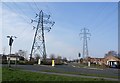
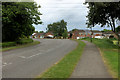
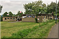
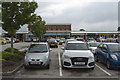
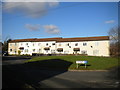
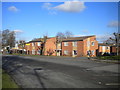
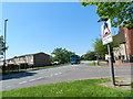
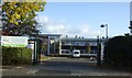
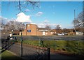
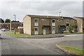
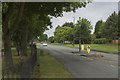
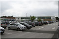
16 photos from this area
Area Information
Key information about the DE24 9PF including its size, population, and administrative classification.
- Area Type
- Postcode
- Area Size
- 1.3 hectares
- Population
- 1677
- Population Density
- 8066 people/km²
House Prices in DE24 9PF
40
Properties
£122,803
Average Sold Price
£32,500
Lowest Price
£280,000
Highest Price
Showing 40 properties
| Address | Type | Beds | Baths | Last Sale Price | Last Sale Date | |
|---|---|---|---|---|---|---|
| 21 Links Close, Derby, DE24 9PF | Detached | 4 | 2 | £280,000 | Dec 2024 | |
| 26 Links Close, Derby, DE24 9PF | Semi-detached | 3 | 1 | £235,000 | May 2024 | |
| 29 Links Close, Derby, DE24 9PF | Semi-detached | 3 | 1 | £185,000 | Sep 2023 | |
| 19 Links Close, Derby, DE24 9PF | house | - | - | £200,000 | Jan 2023 | |
| 11 Links Close, Derby, DE24 9PF | house | - | - | £170,000 | Apr 2022 | |
| 47 Links Close, Derby, DE24 9PF | Detached | 4 | 2 | £171,000 | Aug 2019 | |
| 39 Links Close, Derby, DE24 9PF | Semi-detached | 3 | 1 | £145,000 | Jul 2019 | |
| 18 Links Close, Derby, DE24 9PF | Semi-detached | 3 | 1 | £147,500 | Oct 2018 | |
| 4 Links Close, Derby, DE24 9PF | Semi-detached | 3 | 1 | £143,000 | Aug 2018 | |
| 6 Links Close, Derby, DE24 9PF | house | - | - | £157,000 | Jun 2018 |
Page 1 of 4
Energy Efficiency in DE24 9PF
Amenities
Schools
| Rank | School | Type | Entry gender | Ages |
|---|
Explore more schools in this area
Go to Schools tabDemographics
Household Size
Family (3-5 people)
most common
Accommodation Type
Houses
most common
Tenure
76
majority
Ethnic Group
White
most common
Religion
N/A
most common
Household Composition
N/A
most common
Age
47
median
Adults (30-64 years)
most common
Household Deprivation
N/A
with no deprivation
NS-SEC
17
in Lower managerial occupations
Explore more demographic insights in this area
Go to Demographics tabPlanning
Planning Constraints
- Flood RiskPremium
- Ramsar Wetland SitesPremium
- Area of Outstanding Natural BeautyPremium
- Protected Nature ReservePremium
- Protected WoodlandPremium