Area Overview for DE24 9NW
Photos of DE24 9NW
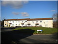
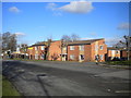
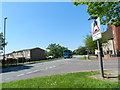
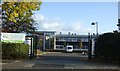
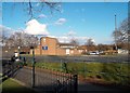
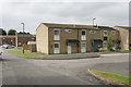
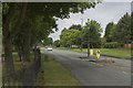
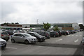
16 photos from this area
Area Information
Key information about the DE24 9NW including its size, population, and administrative classification.
- Area Type
- Postcode
- Area Size
- 1.3 hectares
- Population
- 2041
- Population Density
- 3009 people/km²
House Prices in DE24 9NW
54
Properties
£80,845
Average Sold Price
£26,520
Lowest Price
£165,000
Highest Price
Showing 54 properties
| Address | Type | Beds | Baths | Last Sale Price | Last Sale Date | |
|---|---|---|---|---|---|---|
| 29 Arkle Green, Derby, DE24 9NW | Terraced | 3 | 1 | £107,000 | Oct 2025 | |
| 17 Arkle Green, Derby, DE24 9NW | house | 3 | 1 | £165,000 | Oct 2025 | |
| 40 Arkle Green, Derby, DE24 9NW | Terraced | 3 | 1 | £88,000 | Oct 2023 | |
| 35 Arkle Green, Derby, DE24 9NW | house | 3 | 1 | £109,950 | May 2018 | |
| 21 Arkle Green, Derby, DE24 9NW | house | - | - | £67,500 | Mar 2011 | |
| 46 Arkle Green, Derby, DE24 9NW | Terraced | 3 | - | £99,000 | Oct 2009 | |
| 10 Arkle Green, Derby, DE24 9NW | house | - | - | £80,000 | Apr 2008 | |
| 39 Arkle Green, Derby, DE24 9NW | house | - | - | £107,000 | Aug 2007 | |
| 13 Arkle Green, Derby, DE24 9NW | Terraced | - | - | £98,000 | Oct 2006 | |
| 25 Arkle Green, Derby, DE24 9NW | house | 3 | - | £79,950 | Jun 2005 |
Page 1 of 6
Energy Efficiency in DE24 9NW
Amenities
Schools
| Rank | School | Type | Entry gender | Ages |
|---|
Explore more schools in this area
Go to Schools tabDemographics
Household Size
Family (3-5 people)
most common
Accommodation Type
Houses
most common
Tenure
45
majority
Ethnic Group
White
most common
Religion
N/A
most common
Household Composition
N/A
most common
Age
47
median
Adults (30-64 years)
most common
Household Deprivation
N/A
with no deprivation
NS-SEC
20
in Lower managerial occupations
Explore more demographic insights in this area
Go to Demographics tabPlanning
Planning Constraints
- Flood RiskPremium
- Ramsar Wetland SitesPremium
- Area of Outstanding Natural BeautyPremium
- Protected Nature ReservePremium
- Protected WoodlandPremium