Area Overview for DE24 9LZ
Photos of DE24 9LZ
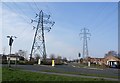
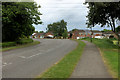
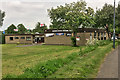
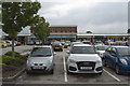
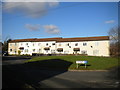
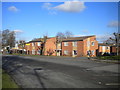
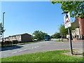
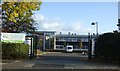
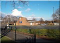
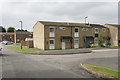
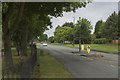
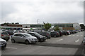
16 photos from this area
Area Information
Key information about the DE24 9LZ including its size, population, and administrative classification.
- Area Type
- Postcode
- Area Size
- 1.2 hectares
- Population
- 1789
- Population Density
- 8634 people/km²
House Prices in DE24 9LZ
46
Properties
£79,406
Average Sold Price
£16,335
Lowest Price
£156,000
Highest Price
Showing 46 properties
| Address | Type | Beds | Baths | Last Sale Price | Last Sale Date | |
|---|---|---|---|---|---|---|
| 35 Athol Close, Derby, DE24 9LZ | house | 4 | 1 | £156,000 | Apr 2024 | |
| 54 Athol Close, Derby, DE24 9LZ | Terraced | 1 | 1 | £100,000 | Dec 2023 | |
| 48 Athol Close, Derby, DE24 9LZ | house | - | - | £135,000 | Dec 2021 | |
| 5 Athol Close, Derby, DE24 9LZ | Terraced | 3 | - | £90,000 | Jun 2015 | |
| 17 Athol Close, Derby, DE24 9LZ | Terraced | 4 | - | £102,950 | Sep 2013 | |
| 52 Athol Close, Derby, DE24 9LZ | Terraced | 3 | 1 | £105,000 | Aug 2008 | |
| 1 Athol Close, Derby, DE24 9LZ | Terraced | - | - | £88,000 | May 2008 | |
| 6 Athol Close, Derby, DE24 9LZ | house | 3 | - | £89,000 | May 2006 | |
| 4 Athol Close, Derby, DE24 9LZ | Terraced | - | - | £65,000 | Oct 2003 | |
| 13 Athol Close, Derby, DE24 9LZ | Terraced | - | - | £62,000 | Sep 2003 |
Page 1 of 5
Energy Efficiency in DE24 9LZ
Amenities
Schools
| Rank | School | Type | Entry gender | Ages |
|---|
Explore more schools in this area
Go to Schools tabDemographics
Household Size
Family (3-5 people)
most common
Accommodation Type
Houses
most common
Tenure
30
majority
Ethnic Group
White
most common
Religion
N/A
most common
Household Composition
N/A
most common
Age
47
median
Adults (30-64 years)
most common
Household Deprivation
N/A
with no deprivation
NS-SEC
18
in Lower managerial occupations
Explore more demographic insights in this area
Go to Demographics tabPlanning
Planning Constraints
- Flood RiskPremium
- Ramsar Wetland SitesPremium
- Area of Outstanding Natural BeautyPremium
- Protected Nature ReservePremium
- Protected WoodlandPremium