Area Overview for DE24 9FD
Photos of DE24 9FD
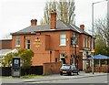
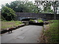
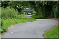
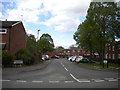
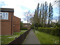
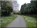
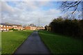


64 photos from this area
Area Information
Key information about the DE24 9FD including its size, population, and administrative classification.
- Area Type
- Postcode
- Area Size
- 2.8 hectares
- Population
- 1518
- Population Density
- 4446 people/km²
House Prices in DE24 9FD
30
Properties
£151,633
Average Sold Price
£35,000
Lowest Price
£295,000
Highest Price
Showing 30 properties
| Address | Type | Beds | Baths | Last Sale Price | Last Sale Date | |
|---|---|---|---|---|---|---|
| 63 Jubilee Road, Derby, DE24 9FD | Detached | 3 | 2 | £295,000 | May 2025 | |
| 98 Jubilee Road, Derby, DE24 9FD | Semi-detached | 3 | 1 | £228,000 | Sep 2021 | |
| 102 Jubilee Road, Derby, DE24 9FD | house | - | - | £240,000 | Jul 2021 | |
| 112 Jubilee Road, Derby, DE24 9FD | Detached | 3 | 1 | £152,000 | Jul 2018 | |
| 100 Jubilee Road, Derby, DE24 9FD | Semi-detached | 3 | 1 | £142,000 | Jun 2018 | |
| 67 Jubilee Road, Derby, DE24 9FD | Detached | 3 | - | £115,000 | Nov 2013 | |
| 116 Jubilee Road, Derby, DE24 9FD | Bungalow | 2 | - | £165,000 | Nov 2013 | |
| 118 Jubilee Road, Derby, DE24 9FD | Bungalow | 2 | - | £125,000 | Jul 2013 | |
| 94 Jubilee Road, Derby, DE24 9FD | Semi-detached | - | - | £135,000 | Jun 2013 | |
| 55 Jubilee Road, Derby, DE24 9FD | house | - | - | £185,000 | Oct 2010 |
Page 1 of 3
Energy Efficiency in DE24 9FD
Amenities
Schools
| Rank | School | Type | Entry gender | Ages |
|---|
Explore more schools in this area
Go to Schools tabDemographics
Household Size
Two person
most common
Accommodation Type
Houses
most common
Tenure
79
majority
Ethnic Group
White
most common
Religion
N/A
most common
Household Composition
N/A
most common
Age
47
median
Adults (30-64 years)
most common
Household Deprivation
N/A
with no deprivation
NS-SEC
34
in Lower managerial occupations
Explore more demographic insights in this area
Go to Demographics tabPlanning
Planning Constraints
- Flood RiskPremium
- Ramsar Wetland SitesPremium
- Area of Outstanding Natural BeautyPremium
- Protected Nature ReservePremium
- Protected WoodlandPremium